This weather event on May 2, 2025 includes:
2 states
16 counties,
20 cities,
and 59 zip codes.
There were 6426 total properties that were impacted and have possible damage.
States Impacted By Hail On May 2, 2025
North Carolina
·
Virginia
Counties Impacted By Hail On May 2, 2025
Beaufort, NC
·
Bertie, NC
·
Chatham, NC
·
Edgecombe, NC
·
Franklin, NC
·
Greene, NC
·
Harnett, NC
·
Johnston, NC
·
Martin, NC
·
Nash, NC
·
Pitt, NC
·
Wake, NC
·
Warren, NC
·
Wilson, NC
·
Lunenburg, VA
·
Mecklenburg, VA
Cities Impacted By Hail On May 2, 2025
Angier, NC
·
Apex, NC
·
Benson, NC
·
Clayton, NC
·
Coats, NC
·
Elm City, NC
·
Farmville, NC
·
Fuquay-Varina, NC
·
Garner, NC
·
Holly Springs, NC
·
Jamesville, NC
·
Kenly, NC
·
Lake Royale, NC
·
Leggett, NC
·
Louisburg, NC
·
Rocky Mount, NC
·
Stantonsburg, NC
·
Stokes, NC
·
Walstonburg, NC
·
Washington, NC
Zip Codes Impacted By Hail On May 2, 2025
23917
·
23919
·
23924
·
23974
·
27501
·
27502
·
27504
·
27508
·
27518
·
27520
·
27526
·
27527
·
27529
·
27539
·
27540
·
27542
·
27546
·
27549
·
27553
·
27557
·
27562
·
27576
·
27587
·
27591
·
27592
·
27597
·
27603
·
27801
·
27803
·
27804
·
27809
·
27812
·
27822
·
27828
·
27829
·
27834
·
27837
·
27846
·
27856
·
27858
·
27871
·
27882
·
27883
·
27884
·
27886
·
27888
·
27889
·
27891
·
27892
·
27893
·
27896
·
27983
·
28334
·
28513
·
28530
·
28538
·
28580
·
28590
·
27521
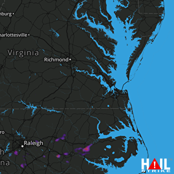 NORFOLK/RICH (KAKQ) RADAR

