This weather event on April 26, 2025 includes:
2 states
22 counties,
24 cities,
and 68 zip codes.
There were 1056 total properties that were impacted and have possible damage.
States Impacted By Hail On April 26, 2025
Oklahoma
·
Texas
Counties Impacted By Hail On April 26, 2025
Atoka, OK
·
Bryan, OK
·
Choctaw, OK
·
Coal, OK
·
Haskell, OK
·
Hughes, OK
·
Johnston, OK
·
Latimer, OK
·
Le Flore, OK
·
Marshall, OK
·
Mayes, OK
·
McCurtain, OK
·
McIntosh, OK
·
Muskogee, OK
·
Okfuskee, OK
·
Okmulgee, OK
·
Pittsburg, OK
·
Pontotoc, OK
·
Pushmataha, OK
·
Seminole, OK
·
Sequoyah, OK
·
Lamar, TX
Cities Impacted By Hail On April 26, 2025
Atoka, OK
·
Braggs, OK
·
Brent, OK
·
Checotah, OK
·
Connerville, OK
·
Cowlington, OK
·
Eufaula, OK
·
Fanshawe, OK
·
Hanna, OK
·
Hugo, OK
·
Lamar, OK
·
Lehigh, OK
·
Madill, OK
·
McAlester, OK
·
Oakland, OK
·
Rentiesville, OK
·
River Bottom, OK
·
Sand Hill, OK
·
Stidham, OK
·
Stringtown, OK
·
Texanna, OK
·
Weleetka, OK
·
Wilburton, OK
·
Yeager, OK
Zip Codes Impacted By Hail On April 26, 2025
73432
·
73439
·
73440
·
73446
·
73447
·
73450
·
73460
·
74337
·
74403
·
74423
·
74426
·
74432
·
74434
·
74437
·
74442
·
74450
·
74459
·
74470
·
74523
·
74525
·
74531
·
74533
·
74536
·
74538
·
74540
·
74543
·
74549
·
74555
·
74556
·
74557
·
74560
·
74561
·
74563
·
74567
·
74569
·
74570
·
74578
·
74723
·
74726
·
74727
·
74728
·
74729
·
74743
·
74759
·
74820
·
74836
·
74839
·
74845
·
74848
·
74850
·
74856
·
74859
·
74871
·
74880
·
74884
·
74930
·
74941
·
74944
·
74953
·
74955
·
74956
·
74957
·
74966
·
75411
·
75486
·
74428
·
74501
·
74883
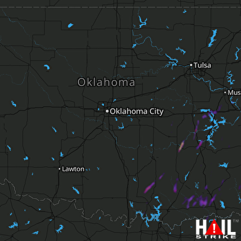 OKLAHOMA CITY (KTLX) RADAR

