This weather event on September 22, 2025 includes:
3 states
17 counties,
29 cities,
and 58 zip codes.
There were total properties that were impacted and have possible damage.
States Impacted By Hail On September 22, 2025
Iowa
·
Minnesota
·
Wisconsin
Counties Impacted By Hail On September 22, 2025
Allamakee, IA
·
Cerro Gordo, IA
·
Chickasaw, IA
·
Clay, IA
·
Floyd, IA
·
Hancock, IA
·
Howard, IA
·
Kossuth, IA
·
Mitchell, IA
·
Palo Alto, IA
·
Winnebago, IA
·
Winneshiek, IA
·
Worth, IA
·
Freeborn, MN
·
Houston, MN
·
Mower, MN
·
Vernon, WI
Cities Impacted By Hail On September 22, 2025
Algona, IA
·
Alta Vista, IA
·
Bolan, IA
·
Caledonia, MN
·
Carpenter, IA
·
Clear Lake, IA
·
Crystal Lake, IA
·
Fertile, IA
·
Grafton, IA
·
Hanlontown, IA
·
Kensett, IA
·
Lawler, IA
·
Leland, IA
·
Mason City, IA
·
Miller, IA
·
Mitchell, IA
·
Mona, IA
·
Nora Springs, IA
·
Otranto, IA
·
Plymouth, IA
·
Portland, IA
·
Protivin, IA
·
Rock Falls, IA
·
Rudd, IA
·
Spencer, IA
·
Spring Grove, MN
·
St. Ansgar, IA
·
Stoddard, WI
·
Ventura, IA
Zip Codes Impacted By Hail On September 22, 2025
50401
·
50423
·
50426
·
50428
·
50432
·
50434
·
50435
·
50436
·
50438
·
50440
·
50444
·
50446
·
50448
·
50450
·
50456
·
50458
·
50459
·
50461
·
50464
·
50467
·
50468
·
50472
·
50482
·
50484
·
50511
·
50515
·
50522
·
50536
·
50597
·
50598
·
50603
·
50616
·
50628
·
50645
·
50659
·
51301
·
51333
·
51358
·
52101
·
52132
·
52140
·
52144
·
52154
·
52163
·
52171
·
54658
·
55912
·
55919
·
55921
·
55953
·
55954
·
55974
·
56036
·
54632
·
54621
·
52172
·
50471
·
50453
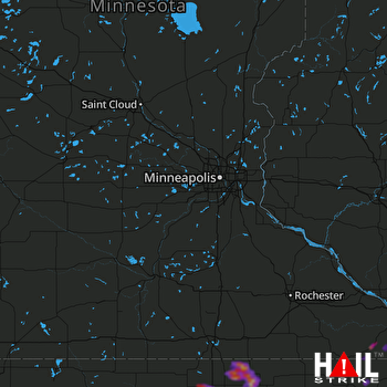 MINNEAPOLIS (KMPX) RADAR

