This weather event on September 17, 2025 includes:
2 states
27 counties,
17 cities,
and 53 zip codes.
There were 2965 total properties that were impacted and have possible damage.
States Impacted By Hail On September 17, 2025
Louisiana
·
Mississippi
Counties Impacted By Hail On September 17, 2025
East Baton Rouge, LA
·
East Feliciana, LA
·
Grant, LA
·
LaSalle, LA
·
Livingston, LA
·
Rapides, LA
·
St. Helena, LA
·
Amite, MS
·
Attala, MS
·
Carroll, MS
·
Choctaw, MS
·
Clay, MS
·
Copiah, MS
·
Franklin, MS
·
Hinds, MS
·
Holmes, MS
·
Jefferson, MS
·
Leake, MS
·
Lincoln, MS
·
Madison, MS
·
Oktibbeha, MS
·
Pike, MS
·
Rankin, MS
·
Simpson, MS
·
Webster, MS
·
Wilkinson, MS
·
Winston, MS
Cities Impacted By Hail On September 17, 2025
Brandon, MS
·
Brookhaven, MS
·
Cleary, MS
·
Crystal Springs, MS
·
Florence, MS
·
Gloster, MS
·
Greensburg, LA
·
Madison, MS
·
Pelahatchie, MS
·
Ridgeland, MS
·
Robinhood, MS
·
Summit, MS
·
Terry, MS
·
Utica, MS
·
Walker, LA
·
Watson, LA
·
Wesson, MS
Zip Codes Impacted By Hail On September 17, 2025
39044
·
39045
·
39046
·
39051
·
39059
·
39067
·
39073
·
39078
·
39082
·
39083
·
39090
·
39094
·
39095
·
39110
·
39114
·
39140
·
39145
·
39149
·
39154
·
39157
·
39170
·
39175
·
39176
·
39191
·
39212
·
39339
·
39601
·
39629
·
39631
·
39633
·
39638
·
39645
·
39664
·
39666
·
39668
·
39735
·
39750
·
39752
·
39755
·
39769
·
70441
·
70444
·
70706
·
70722
·
70726
·
70754
·
70777
·
70785
·
71328
·
71342
·
71467
·
39042
·
70739
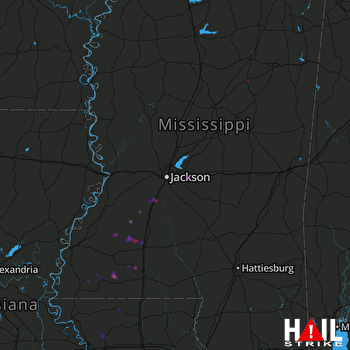 JACKSON (KDGX) RADAR

