This weather event on August 15, 2026 includes:
2 states
29 counties,
14 cities,
and 50 zip codes.
There were 581 total properties that were impacted and have possible damage.
States Impacted By Hail On August 15, 2026
Indiana
·
Kentucky
Counties Impacted By Hail On August 15, 2026
Jefferson, IN
·
Bath, KY
·
Boone, KY
·
Bourbon, KY
·
Breathitt, KY
·
Carroll, KY
·
Clark, KY
·
Estill, KY
·
Fayette, KY
·
Fleming, KY
·
Franklin, KY
·
Gallatin, KY
·
Grant, KY
·
Harrison, KY
·
Henry, KY
·
Kenton, KY
·
Lee, KY
·
Mason, KY
·
Montgomery, KY
·
Nicholas, KY
·
Owen, KY
·
Owsley, KY
·
Pendleton, KY
·
Powell, KY
·
Robertson, KY
·
Scott, KY
·
Shelby, KY
·
Trimble, KY
·
Wolfe, KY
Cities Impacted By Hail On August 15, 2026
Carlisle, KY
·
Clay City, KY
·
Corinth, KY
·
Crittenden, KY
·
Cynthiana, KY
·
Elizaville, KY
·
Ewing, KY
·
Glencoe, KY
·
Lexington-Fayette, KY
·
Pleasureville, KY
·
Sadieville, KY
·
Stanton, KY
·
Williamstown, KY
·
Winchester, KY
Zip Codes Impacted By Hail On August 15, 2026
40003
·
40006
·
40019
·
40045
·
40057
·
40065
·
40311
·
40312
·
40324
·
40336
·
40337
·
40350
·
40353
·
40359
·
40361
·
40370
·
40374
·
40376
·
40379
·
40380
·
40391
·
40472
·
40511
·
40601
·
41003
·
41010
·
41030
·
41031
·
41035
·
41039
·
41040
·
41041
·
41046
·
41052
·
41055
·
41056
·
41064
·
41083
·
41086
·
41091
·
41092
·
41095
·
41097
·
41098
·
41301
·
41311
·
41314
·
41360
·
41365
·
47243
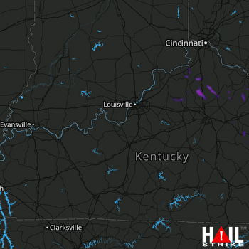 LOUISVILLE (KLVX) RADAR

