This weather event on June 16, 2026 includes:
2 states
22 counties,
23 cities,
and 60 zip codes.
There were 5795 total properties that were impacted and have possible damage.
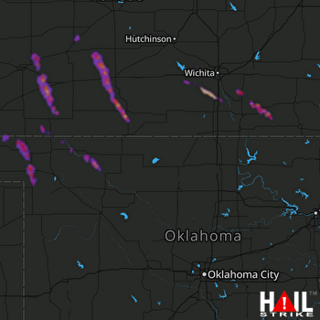 VANCE AFB (KVNX) RADAR
States Impacted By Hail On June 16, 2026
Kansas
·
Oklahoma
Counties Impacted By Hail On June 16, 2026
Barber, KS
·
Butler, KS
·
Clark, KS
·
Comanche, KS
·
Cowley, KS
·
Edwards, KS
·
Ford, KS
·
Hodgeman, KS
·
Kingman, KS
·
Meade, KS
·
Montgomery, KS
·
Pawnee, KS
·
Pratt, KS
·
Sedgwick, KS
·
Stafford, KS
·
Sumner, KS
·
Beaver, OK
·
Ellis, OK
·
Harper, OK
·
Logan, OK
·
Woods, OK
·
Woodward, OK
Cities Impacted By Hail On June 16, 2026
Andale, KS
·
Belle Plaine, KS
·
Bucklin, KS
·
Burden, KS
·
Byers, KS
·
Cambridge, KS
·
Cheney, KS
·
Clearwater, KS
·
Coats, KS
·
Cullison, KS
·
Douglass, KS
·
Elk City, KS
·
Ford, KS
·
Freedom, OK
·
Garfield, KS
·
Gate, OK
·
Independence, KS
·
Laverne, OK
·
Macksville, KS
·
Medicine Lodge, KS
·
Rosston, OK
·
Spearville, KS
·
Winfield, KS
Zip Codes Impacted By Hail On June 16, 2026
67066
·
74881
·
73860
·
73855
·
73852
·
73851
·
73848
·
73844
·
73843
·
73842
·
73834
·
73058
·
67882
·
67876
·
67864
·
67854
·
67842
·
67834
·
67831
·
67801
·
67576
·
67557
·
67529
·
67519
·
67363
·
67344
·
67301
·
67156
·
67152
·
67149
·
67146
·
67138
·
67134
·
67133
·
67131
·
67127
·
67124
·
67120
·
67110
·
67108
·
67104
·
67071
·
67070
·
67059
·
67052
·
67050
·
67039
·
67038
·
67030
·
67028
·
67026
·
67025
·
67024
·
67023
·
67021
·
67019
·
67013
·
67008
·
67001
·
66736

