This weather event on June 9, 2026 includes:
3 states
24 counties,
25 cities,
and 74 zip codes.
There were total properties that were impacted and have possible damage.
States Impacted By Hail On June 9, 2026
Iowa
·
Minnesota
·
Nebraska
Counties Impacted By Hail On June 9, 2026
Buena Vista, IA
·
Cherokee, IA
·
Clay, IA
·
Dickinson, IA
·
Emmet, IA
·
Harrison, IA
·
Ida, IA
·
Kossuth, IA
·
Monona, IA
·
O'Brien, IA
·
Palo Alto, IA
·
Plymouth, IA
·
Pocahontas, IA
·
Pottawattamie, IA
·
Woodbury, IA
·
Faribault, MN
·
Freeborn, MN
·
Jackson, MN
·
Martin, MN
·
Burt, NE
·
Dodge, NE
·
Douglas, NE
·
Saunders, NE
·
Washington, NE
Cities Impacted By Hail On June 9, 2026
Arlington, NE
·
Armstrong, IA
·
Bancroft, IA
·
Delavan, MN
·
Easton, MN
·
Emmetsburg, IA
·
Everly, IA
·
Hartland, MN
·
King Lake, NE
·
Lakota, IA
·
Lone Rock, IA
·
Marathon, IA
·
Okoboji, IA
·
Omaha, NE
·
Orleans, IA
·
Pierson, IA
·
Ruthven, IA
·
Spirit Lake, IA
·
Valley, NE
·
Venice, NE
·
Wahpeton, IA
·
Waterloo, NE
·
Wells, MN
·
West Okoboji, IA
·
Yutan, NE
Zip Codes Impacted By Hail On June 9, 2026
56097
·
51010
·
50568
·
50514
·
68152
·
68112
·
68073
·
68069
·
68064
·
68061
·
68045
·
68025
·
68023
·
68022
·
68019
·
68003
·
68002
·
56143
·
56098
·
56072
·
56068
·
56042
·
56039
·
56032
·
56031
·
56025
·
56023
·
56013
·
56009
·
51555
·
51545
·
51366
·
51360
·
51358
·
51355
·
51351
·
51346
·
51343
·
51342
·
51338
·
51333
·
51331
·
51301
·
51063
·
51061
·
51049
·
51048
·
51040
·
51039
·
51033
·
51028
·
51026
·
51025
·
51016
·
51012
·
51005
·
51004
·
51002
·
50598
·
50588
·
50585
·
50578
·
50565
·
50559
·
50554
·
50539
·
50536
·
50528
·
50527
·
50522
·
50517
·
50510
·
50480
·
50451
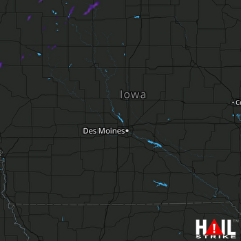 DES MOINES (KDMX) RADAR

