This weather event on April 30, 2026 includes:
2 states
21 counties,
17 cities,
and 50 zip codes.
There were total properties that were impacted and have possible damage.
States Impacted By Hail On April 30, 2026
Louisiana
·
Texas
Counties Impacted By Hail On April 30, 2026
Acadia, LA
·
Allen, LA
·
Ascension, LA
·
Calcasieu, LA
·
East Baton Rouge, LA
·
Evangeline, LA
·
Iberville, LA
·
Jefferson Davis, LA
·
Lafayette, LA
·
Rapides, LA
·
St. Landry, LA
·
Vermilion, LA
·
Vernon, LA
·
Cherokee, TX
·
Nacogdoches, TX
·
Polk, TX
·
Sabine, TX
·
San Jacinto, TX
·
Trinity, TX
·
Tyler, TX
·
Walker, TX
Cities Impacted By Hail On April 30, 2026
Cedar Point, TX
·
Egan, LA
·
Fort Polk North, LA
·
Fort Polk South, LA
·
Indian Springs, TX
·
Lafayette, LA
·
Livingston, TX
·
Mermentau, LA
·
New Llano, LA
·
Oakdale, LA
·
Oakhurst, TX
·
Old Jefferson, LA
·
Onalaska, TX
·
Point Blank, TX
·
Prairieville, LA
·
Sulphur, LA
·
West Livingston, TX
Zip Codes Impacted By Hail On April 30, 2026
70669
·
70769
·
71463
·
77664
·
77624
·
77616
·
77364
·
77360
·
77359
·
77351
·
77334
·
77331
·
77320
·
75979
·
75972
·
75936
·
75926
·
75925
·
75862
·
75847
·
75788
·
75785
·
75784
·
75760
·
71459
·
71446
·
71433
·
71358
·
71353
·
70817
·
70810
·
70809
·
70776
·
70668
·
70663
·
70656
·
70655
·
70633
·
70615
·
70589
·
70586
·
70578
·
70559
·
70556
·
70546
·
70537
·
70531
·
70529
·
70508
·
70346
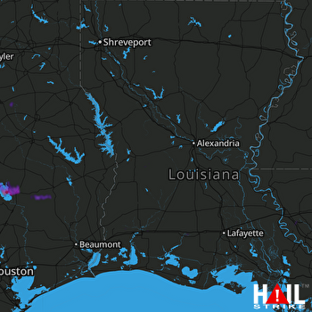 FORT POLK (KPOE) RADAR

