This weather event on April 15, 2026 includes:
3 states
16 counties,
32 cities,
and 50 zip codes.
There were 455 total properties that were impacted and have possible damage.
States Impacted By Hail On April 15, 2026
Arkansas
·
Missouri
·
Oklahoma
Counties Impacted By Hail On April 15, 2026
Benton, AR
·
Newton, MO
·
Adair, OK
·
Cherokee, OK
·
Craig, OK
·
Creek, OK
·
Delaware, OK
·
Mayes, OK
·
McIntosh, OK
·
Muskogee, OK
·
Okfuskee, OK
·
Okmulgee, OK
·
Ottawa, OK
·
Rogers, OK
·
Tulsa, OK
·
Wagoner, OK
Cities Impacted By Hail On April 15, 2026
Beggs, OK
·
Bixby, OK
·
Broken Arrow, OK
·
Cherokee City, AR
·
Claremore, OK
·
Colcord, OK
·
Coweta, OK
·
Dewar, OK
·
Fair Oaks, OK
·
Flint Creek, OK
·
Haskell, OK
·
Henryetta, OK
·
Kansas, OK
·
Leach, OK
·
Liberty, OK
·
Lost City, OK
·
Narcissa, OK
·
Oaks, OK
·
Okmulgee, OK
·
Peggs, OK
·
Porter, OK
·
Redbird, OK
·
Rocky Ford, OK
·
Schulter, OK
·
Sportsmen Acres, OK
·
Teresita, OK
·
Tulsa, OK
·
Twin Oaks, OK
·
Vinita, OK
·
Wagoner, OK
·
Winchester, OK
·
Wyandotte, OK
Zip Codes Impacted By Hail On April 15, 2026
74014
·
74338
·
74457
·
74860
·
74859
·
74833
·
74829
·
74467
·
74464
·
74460
·
74458
·
74456
·
74454
·
74452
·
74447
·
74445
·
74441
·
74437
·
74436
·
74434
·
74432
·
74431
·
74429
·
74426
·
74422
·
74421
·
74370
·
74364
·
74361
·
74359
·
74354
·
74352
·
74347
·
74346
·
74343
·
74333
·
74331
·
74301
·
74047
·
74036
·
74019
·
74015
·
74011
·
74010
·
74008
·
72761
·
72736
·
72734
·
72722
·
64804
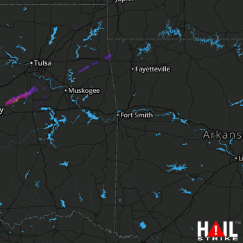 FORT SMITH (KSRX) RADAR

