This weather event on April 13, 2026 includes:
1 states
16 counties,
34 cities,
and 65 zip codes.
There were 1813 total properties that were impacted and have possible damage.
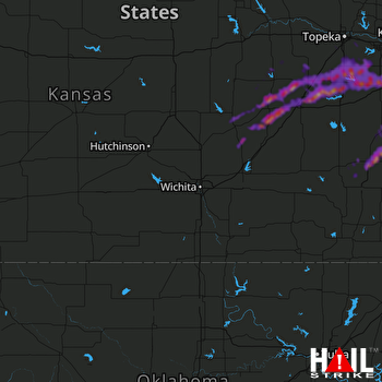 WICHITA (KICT) RADAR
States Impacted By Hail On April 13, 2026
Kansas
Counties Impacted By Hail On April 13, 2026
Allen, KS
·
Anderson, KS
·
Bourbon, KS
·
Butler, KS
·
Chase, KS
·
Douglas, KS
·
Franklin, KS
·
Linn, KS
·
Lyon, KS
·
Marion, KS
·
Miami, KS
·
Morris, KS
·
Osage, KS
·
Shawnee, KS
·
Wabaunsee, KS
·
Woodson, KS
Cities Impacted By Hail On April 13, 2026
Admire, KS
·
Allen, KS
·
Americus, KS
·
Baldwin City, KS
·
Bassett, KS
·
Blue Mound, KS
·
Burlingame, KS
·
Burns, KS
·
Bushong, KS
·
Carbondale, KS
·
Cottonwood Falls, KS
·
Dunlap, KS
·
Emporia, KS
·
Garnett, KS
·
Gas, KS
·
Iola, KS
·
Kincaid, KS
·
La Harpe, KS
·
Lyndon, KS
·
Mildred, KS
·
Mound City, KS
·
Osage City, KS
·
Ottawa, KS
·
Overbrook, KS
·
Piqua, KS
·
Pomona, KS
·
Quenemo, KS
·
Reading, KS
·
Scranton, KS
·
Strong City, KS
·
Vassar, KS
·
Wakarusa, KS
·
Welda, KS
·
Wilsey, KS
Zip Codes Impacted By Hail On April 13, 2026
66015
·
66751
·
66834
·
66873
·
66869
·
66868
·
66866
·
66862
·
66861
·
66856
·
66851
·
66850
·
66849
·
66846
·
66845
·
66843
·
66840
·
66838
·
66835
·
66833
·
66830
·
66801
·
66783
·
66761
·
66755
·
66754
·
66749
·
66748
·
66716
·
66610
·
66546
·
66543
·
66542
·
66537
·
66528
·
66524
·
66523
·
66510
·
66451
·
66431
·
66423
·
66414
·
66413
·
66409
·
66402
·
66401
·
66095
·
66092
·
66091
·
66079
·
66076
·
66072
·
66067
·
66064
·
66056
·
66050
·
66047
·
66046
·
66042
·
66039
·
66033
·
66032
·
66014
·
66010
·
66006

