This weather event on March 11, 2026 includes:
3 states
21 counties,
19 cities,
and 56 zip codes.
There were 1253 total properties that were impacted and have possible damage.
States Impacted By Hail On March 11, 2026
Arkansas
·
Louisiana
·
Texas
Counties Impacted By Hail On March 11, 2026
Columbia, AR
·
Lafayette, AR
·
Union, AR
·
Bienville, LA
·
Bossier, LA
·
Caddo, LA
·
Claiborne, LA
·
De Soto, LA
·
Lincoln, LA
·
Red River, LA
·
Sabine, LA
·
Webster, LA
·
Angelina, TX
·
Cherokee, TX
·
Harrison, TX
·
Houston, TX
·
Nacogdoches, TX
·
Polk, TX
·
San Augustine, TX
·
Shelby, TX
·
Trinity, TX
Cities Impacted By Hail On March 11, 2026
Benton, LA
·
Blanchard, LA
·
Bryceland, LA
·
Corrigan, TX
·
Cotton Valley, LA
·
Hall Summit, LA
·
Haynesville, LA
·
Hudson, TX
·
Huxley, TX
·
Jamestown, LA
·
Lufkin, TX
·
Mooringsport, LA
·
Pleasant Hill, TX
·
Redland, TX
·
San Augustine, TX
·
Sarepta, LA
·
Shongaloo, LA
·
Taylor, AR
·
Waskom, TX
Zip Codes Impacted By Hail On March 11, 2026
71001
·
71004
·
71006
·
71008
·
71016
·
71018
·
71019
·
71024
·
71029
·
71034
·
71037
·
71038
·
71045
·
71052
·
71055
·
71060
·
71061
·
71064
·
71068
·
71071
·
71072
·
71082
·
71107
·
71110
·
71111
·
71119
·
71275
·
71419
·
71730
·
71740
·
71749
·
71753
·
71860
·
71861
·
75692
·
75847
·
75851
·
75862
·
75901
·
75904
·
75925
·
75926
·
75929
·
75935
·
75939
·
75941
·
75944
·
75949
·
75960
·
75961
·
75964
·
75972
·
75973
·
75969
·
75937
·
71028
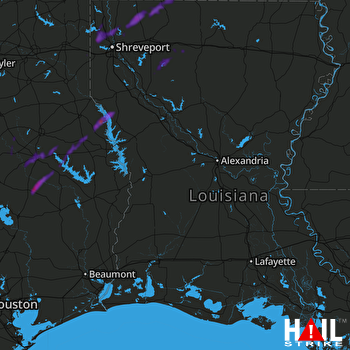 FORT POLK (KPOE) RADAR

