This weather event on October 18, 2025 includes:
2 states
20 counties,
17 cities,
and 55 zip codes.
There were 654 total properties that were impacted and have possible damage.
States Impacted By Hail On October 18, 2025
Louisiana
·
Texas
Counties Impacted By Hail On October 18, 2025
Beauregard, LA
·
Cameron, LA
·
Angelina, TX
·
Brazoria, TX
·
Cherokee, TX
·
Galveston, TX
·
Grimes, TX
·
Houston, TX
·
Jasper, TX
·
Madison, TX
·
Montgomery, TX
·
Nacogdoches, TX
·
Newton, TX
·
Polk, TX
·
Sabine, TX
·
San Augustine, TX
·
San Jacinto, TX
·
Trinity, TX
·
Tyler, TX
·
Walker, TX
Cities Impacted By Hail On October 18, 2025
Alvin, TX
·
Anderson, TX
·
Broaddus, TX
·
Browndell, TX
·
Cedar Point, TX
·
Corrigan, TX
·
Hudson, TX
·
Jasper, TX
·
League City, TX
·
Liverpool, TX
·
Lufkin, TX
·
Onalaska, TX
·
Pleasant Hill, TX
·
Point Blank, TX
·
Sam Rayburn, TX
·
Santa Fe, TX
·
Zavalla, TX
Zip Codes Impacted By Hail On October 18, 2025
77612
·
70631
·
70653
·
75835
·
75844
·
75845
·
75847
·
75851
·
75852
·
75856
·
75862
·
75901
·
75904
·
75925
·
75928
·
75929
·
75931
·
75936
·
75937
·
75939
·
75941
·
75943
·
75944
·
75948
·
75949
·
75951
·
75956
·
75960
·
75961
·
75964
·
75966
·
75968
·
75969
·
75972
·
75976
·
75977
·
75978
·
75979
·
75980
·
77331
·
77340
·
77351
·
77356
·
77358
·
77359
·
77360
·
77364
·
77511
·
77517
·
77577
·
77660
·
77830
·
77864
·
77868
·
77873
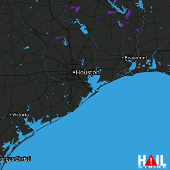 HOUSTON (KHGX) RADAR

