This weather event on September 21, 2025 includes:
2 states
36 counties,
10 cities,
and 89 zip codes.
There were 387 total properties that were impacted and have possible damage.
States Impacted By Hail On September 21, 2025
Alabama
·
Mississippi
Counties Impacted By Hail On September 21, 2025
Choctaw, AL
·
Greene, AL
·
Marengo, AL
·
Sumter, AL
·
Washington, AL
·
Attala, MS
·
Bolivar, MS
·
Choctaw, MS
·
Clarke, MS
·
Coahoma, MS
·
George, MS
·
Greene, MS
·
Grenada, MS
·
Holmes, MS
·
Humphreys, MS
·
Jasper, MS
·
Jones, MS
·
Kemper, MS
·
Lauderdale, MS
·
Leake, MS
·
Lowndes, MS
·
Madison, MS
·
Neshoba, MS
·
Newton, MS
·
Noxubee, MS
·
Oktibbeha, MS
·
Perry, MS
·
Pontotoc, MS
·
Quitman, MS
·
Rankin, MS
·
Scott, MS
·
Smith, MS
·
Wayne, MS
·
Winston, MS
·
Yalobusha, MS
·
Yazoo, MS
Cities Impacted By Hail On September 21, 2025
Bellamy, AL
·
Chatom, AL
·
Ellisville, MS
·
Madison, MS
·
Meridian, MS
·
Polkville, MS
·
Richton, MS
·
Ridgeland, MS
·
Sebastopol, MS
·
Soso, MS
Zip Codes Impacted By Hail On September 21, 2025
35462
·
35470
·
36518
·
36558
·
36732
·
36782
·
36784
·
36904
·
36925
·
38614
·
38643
·
38646
·
38720
·
38740
·
38746
·
38759
·
38762
·
38767
·
38863
·
38864
·
38924
·
39042
·
39045
·
39046
·
39047
·
39057
·
39063
·
39074
·
39079
·
39094
·
39095
·
39108
·
39110
·
39111
·
39114
·
39116
·
39145
·
39146
·
39153
·
39157
·
39160
·
39179
·
39189
·
39192
·
39194
·
39301
·
39305
·
39307
·
39320
·
39322
·
39326
·
39327
·
39328
·
39330
·
39335
·
39337
·
39339
·
39341
·
39346
·
39347
·
39350
·
39354
·
39355
·
39356
·
39359
·
39360
·
39361
·
39364
·
39365
·
39366
·
39367
·
39425
·
39439
·
39443
·
39451
·
39452
·
39456
·
39462
·
39476
·
39480
·
39701
·
39735
·
39739
·
39759
·
39769
·
38922
·
39092
·
39117
·
39437
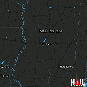 JACKSON (KDGX) RADAR

