This weather event on September 9, 2025 includes:
3 states
23 counties,
22 cities,
and 72 zip codes.
There were 63 total properties that were impacted and have possible damage.
States Impacted By Hail On September 9, 2025
Iowa
·
Kansas
·
Missouri
Counties Impacted By Hail On September 9, 2025
Page, IA
·
Taylor, IA
·
Chase, KS
·
Douglas, KS
·
Elk, KS
·
Franklin, KS
·
Geary, KS
·
Greenwood, KS
·
Johnson, KS
·
Marshall, KS
·
Miami, KS
·
Morris, KS
·
Osage, KS
·
Pottawatomie, KS
·
Riley, KS
·
Shawnee, KS
·
Wabaunsee, KS
·
Wilson, KS
·
Woodson, KS
·
Wyandotte, KS
·
Buchanan, MO
·
Cass, MO
·
Jackson, MO
Cities Impacted By Hail On September 9, 2025
Alma, KS
·
Bonner Springs, KS
·
Burlingame, KS
·
Coyville, KS
·
De Kalb, MO
·
Edgerton, KS
·
Edwardsville, KS
·
Eskridge, KS
·
Fredonia, KS
·
Herington, KS
·
Independence, MO
·
Kansas City, KS
·
Kansas City, MO
·
Lake Quivira, KS
·
Leonardville, KS
·
Manhattan, KS
·
Milford, KS
·
Shawnee, KS
·
St. George, KS
·
Sugar Creek, MO
·
Topeka, KS
·
Vassar, KS
Zip Codes Impacted By Hail On September 9, 2025
51632
·
51646
·
64050
·
64054
·
64080
·
64132
·
64138
·
64139
·
64440
·
64448
·
66012
·
66013
·
66021
·
66025
·
66030
·
66053
·
66076
·
66083
·
66111
·
66112
·
66217
·
66218
·
66401
·
66411
·
66413
·
66414
·
66423
·
66441
·
66451
·
66502
·
66503
·
66506
·
66507
·
66514
·
66520
·
66523
·
66524
·
66526
·
66528
·
66531
·
66535
·
66537
·
66542
·
66543
·
66546
·
66547
·
66548
·
66549
·
66554
·
66605
·
66607
·
66609
·
66736
·
66777
·
66834
·
66838
·
66843
·
66845
·
66846
·
66849
·
66850
·
66853
·
66860
·
66862
·
66865
·
66869
·
66872
·
66873
·
67045
·
67047
·
67449
·
66449
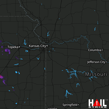 KANSAS CITY (KEAX) RADAR

