This weather event on August 27, 2025 includes:
1 states
13 counties,
23 cities,
and 60 zip codes.
There were 830 total properties that were impacted and have possible damage.
States Impacted By Hail On August 27, 2025
Minnesota
Counties Impacted By Hail On August 27, 2025
Blue Earth, MN
·
Brown, MN
·
Cottonwood, MN
·
Le Sueur, MN
·
Lincoln, MN
·
Lyon, MN
·
Murray, MN
·
Nicollet, MN
·
Pipestone, MN
·
Redwood, MN
·
Renville, MN
·
Sibley, MN
·
Watonwan, MN
Cities Impacted By Hail On August 27, 2025
Avoca, MN
·
Balaton, MN
·
Courtland, MN
·
Currie, MN
·
Garvin, MN
·
Lafayette, MN
·
Lamberton, MN
·
Lucan, MN
·
Madelia, MN
·
Mankato, MN
·
Morgan, MN
·
Morton, MN
·
New Ulm, MN
·
North Mankato, MN
·
Redwood Falls, MN
·
Russell, MN
·
Sanborn, MN
·
Searles, MN
·
Slayton, MN
·
Springfield, MN
·
Storden, MN
·
The Lakes, MN
·
Wanda, MN
Zip Codes Impacted By Hail On August 27, 2025
55307
·
55334
·
55335
·
55396
·
56001
·
56003
·
56019
·
56021
·
56041
·
56050
·
56054
·
56055
·
56058
·
56060
·
56062
·
56073
·
56074
·
56081
·
56082
·
56083
·
56085
·
56087
·
56090
·
56101
·
56113
·
56114
·
56115
·
56118
·
56123
·
56132
·
56139
·
56141
·
56142
·
56145
·
56149
·
56151
·
56152
·
56157
·
56166
·
56169
·
56172
·
56174
·
56175
·
56178
·
56180
·
56183
·
56186
·
56214
·
56230
·
56255
·
56263
·
56266
·
56270
·
56277
·
56283
·
56284
·
56285
·
56292
·
56293
·
56294
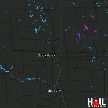 SIOUX FALLS (KFSD) RADAR

