This weather event on August 9, 2025 includes:
2 states
23 counties,
19 cities,
and 61 zip codes.
There were 11060 total properties that were impacted and have possible damage.
States Impacted By Hail On August 9, 2025
Louisiana
·
Texas
Counties Impacted By Hail On August 9, 2025
Calcasieu, LA
·
Cameron, LA
·
Jefferson Davis, LA
·
Austin, TX
·
Colorado, TX
·
DeWitt, TX
·
Fayette, TX
·
Fort Bend, TX
·
Gonzales, TX
·
Harris, TX
·
Jasper, TX
·
Jefferson, TX
·
Nacogdoches, TX
·
Newton, TX
·
Orange, TX
·
Polk, TX
·
Sabine, TX
·
San Augustine, TX
·
Trinity, TX
·
Victoria, TX
·
Waller, TX
·
Washington, TX
·
Wharton, TX
Cities Impacted By Hail On August 9, 2025
Beaumont, TX
·
Bellville, TX
·
Brazos Country, TX
·
Broaddus, TX
·
Brookshire, TX
·
Columbus, TX
·
Eagle Lake, TX
·
Four Corners, TX
·
Glidden, TX
·
Hempstead, TX
·
Katy, TX
·
Meadows Place, TX
·
Mission Bend, TX
·
Orange, TX
·
Pattison, TX
·
Simonton, TX
·
Stafford, TX
·
Sugar Land, TX
·
Victoria, TX
Zip Codes Impacted By Hail On August 9, 2025
70542
·
70549
·
70591
·
70607
·
70631
·
70632
·
70643
·
70646
·
70663
·
70668
·
75845
·
75929
·
75930
·
75931
·
75939
·
75944
·
75948
·
75968
·
75972
·
75977
·
77083
·
77099
·
77407
·
77412
·
77418
·
77423
·
77426
·
77433
·
77434
·
77435
·
77441
·
77445
·
77449
·
77454
·
77466
·
77474
·
77477
·
77478
·
77485
·
77493
·
77632
·
77713
·
77880
·
77901
·
77904
·
77905
·
77954
·
77968
·
77994
·
77995
·
78933
·
78934
·
78935
·
78938
·
78940
·
78943
·
78945
·
78950
·
78962
·
70630
·
77498
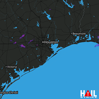 HOUSTON (KHGX) RADAR

