This weather event on July 27, 2025 includes:
1 states
23 counties,
21 cities,
and 77 zip codes.
There were 97 total properties that were impacted and have possible damage.
States Impacted By Hail On July 27, 2025
North Carolina
Counties Impacted By Hail On July 27, 2025
Beaufort, NC
·
Chatham, NC
·
Craven, NC
·
Cumberland, NC
·
Durham, NC
·
Edgecombe, NC
·
Franklin, NC
·
Granville, NC
·
Greene, NC
·
Harnett, NC
·
Johnston, NC
·
Jones, NC
·
Lee, NC
·
Lenoir, NC
·
Martin, NC
·
Moore, NC
·
Nash, NC
·
Pitt, NC
·
Robeson, NC
·
Sampson, NC
·
Wake, NC
·
Wayne, NC
·
Wilson, NC
Cities Impacted By Hail On July 27, 2025
Angier, NC
·
Apex, NC
·
Archer Lodge, NC
·
Bailey, NC
·
Cameron, NC
·
Clayton, NC
·
Four Oaks, NC
·
Fuquay-Varina, NC
·
Garner, NC
·
Goldsboro, NC
·
Hope Mills, NC
·
Knightdale, NC
·
La Grange, NC
·
Newton Grove, NC
·
Rolesville, NC
·
Sanford, NC
·
Selma, NC
·
Sharpsburg, NC
·
Wake Forest, NC
·
Wendell, NC
·
Wilson, NC
Zip Codes Impacted By Hail On July 27, 2025
27207
·
27332
·
27501
·
27502
·
27504
·
27519
·
27520
·
27521
·
27523
·
27524
·
27526
·
27527
·
27529
·
27530
·
27534
·
27539
·
27542
·
27545
·
27557
·
27560
·
27569
·
27571
·
27576
·
27577
·
27587
·
27591
·
27592
·
27596
·
27597
·
27603
·
27604
·
27610
·
27614
·
27616
·
27617
·
27703
·
27801
·
27807
·
27822
·
27830
·
27834
·
27846
·
27851
·
27856
·
27863
·
27865
·
27880
·
27882
·
27883
·
27888
·
27889
·
27892
·
27896
·
28304
·
28305
·
28306
·
28314
·
28326
·
28327
·
28334
·
28348
·
28360
·
28365
·
28366
·
28377
·
28386
·
28504
·
28525
·
28532
·
28551
·
28555
·
28573
·
28585
·
27330
·
27803
·
27878
·
28303
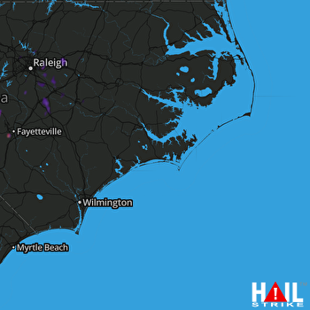 MOREHEAD CITY (KMHX) RADAR

