This weather event on July 21, 2025 includes:
3 states
32 counties,
92 cities,
and 168 zip codes.
There were 890 total properties that were impacted and have possible damage.
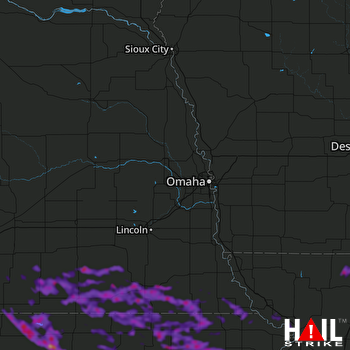 OMAHA (KOAX) RADAR
States Impacted By Hail On July 21, 2025
Kansas
·
Missouri
·
Nebraska
Counties Impacted By Hail On July 21, 2025
Atchison, KS
·
Brown, KS
·
Cloud, KS
·
Doniphan, KS
·
Jackson, KS
·
Jefferson, KS
·
Jewell, KS
·
Marshall, KS
·
Nemaha, KS
·
Pottawatomie, KS
·
Republic, KS
·
Riley, KS
·
Smith, KS
·
Washington, KS
·
Andrew, MO
·
Gentry, MO
·
Harrison, MO
·
Holt, MO
·
Worth, MO
·
Adams, NE
·
Clay, NE
·
Fillmore, NE
·
Gage, NE
·
Jefferson, NE
·
Johnson, NE
·
Kearney, NE
·
Nuckolls, NE
·
Pawnee, NE
·
Richardson, NE
·
Saline, NE
·
Thayer, NE
·
Webster, NE
Cities Impacted By Hail On July 21, 2025
Alexandria, NE
·
Axtell, KS
·
Baileyville, KS
·
Beatrice, NE
·
Beattie, KS
·
Belvidere, NE
·
Bern, KS
·
Blue Springs, NE
·
Bruning, NE
·
Burchard, NE
·
Burr Oak, KS
·
Carleton, NE
·
Centralia, KS
·
Circleville, KS
·
Concordia, KS
·
Corning, KS
·
Courtland, KS
·
Davenport, NE
·
Daykin, NE
·
Deshler, NE
·
Deweese, NE
·
Diller, NE
·
Du Bois, NE
·
Eagleville, MO
·
Edgar, NE
·
Emmett, KS
·
Fairbury, NE
·
Fairfield, NE
·
Falls City, NE
·
Filley, NE
·
Forest City, MO
·
Formoso, KS
·
Frankfort, KS
·
Gilead, NE
·
Goff, KS
·
Haddam, KS
·
Hanover, KS
·
Harbine, NE
·
Hardy, NE
·
Havensville, KS
·
Hebron, NE
·
Hollenberg, KS
·
Holmesville, NE
·
Holton, KS
·
Home, KS
·
Hubbell, NE
·
Jamestown, KS
·
Jansen, NE
·
Leonardville, KS
·
Mahaska, KS
·
Manhattan, KS
·
Mankato, KS
·
Marysville, KS
·
Mayetta, KS
·
Morrowville, KS
·
Munden, KS
·
Muscotah, KS
·
Netawaka, KS
·
Oak, NE
·
Odell, NE
·
Ohiowa, NE
·
Oketo, KS
·
Onaga, KS
·
Oregon, MO
·
Pawnee City, NE
·
Plymouth, NE
·
Preston, NE
·
Randall, KS
·
Randolph, KS
·
Red Cloud, NE
·
Reserve, KS
·
Reynolds, NE
·
Sabetha, KS
·
Salem, NE
·
Savannah, MO
·
Scandia, KS
·
Seneca, KS
·
Shickley, NE
·
Steele City, NE
·
Strang, NE
·
Superior, NE
·
Tobias, NE
·
Vermillion, KS
·
Virginia, NE
·
Washington, KS
·
Webber, KS
·
Western, NE
·
Westmoreland, KS
·
Wetmore, KS
·
Wheaton, KS
·
Whiting, KS
·
Wymore, NE
Zip Codes Impacted By Hail On July 21, 2025
64402
·
64421
·
64437
·
64441
·
64442
·
64451
·
64456
·
64467
·
64471
·
64473
·
64481
·
64485
·
64505
·
66002
·
66023
·
66058
·
66060
·
66088
·
66090
·
66094
·
66097
·
66403
·
66404
·
66406
·
66407
·
66408
·
66411
·
66412
·
66415
·
66416
·
66417
·
66418
·
66419
·
66422
·
66427
·
66428
·
66432
·
66434
·
66436
·
66438
·
66439
·
66440
·
66449
·
66503
·
66508
·
66509
·
66512
·
66515
·
66516
·
66518
·
66520
·
66531
·
66532
·
66534
·
66535
·
66536
·
66538
·
66540
·
66544
·
66547
·
66548
·
66549
·
66550
·
66552
·
66554
·
66901
·
66930
·
66933
·
66935
·
66936
·
66937
·
66938
·
66939
·
66940
·
66941
·
66942
·
66943
·
66944
·
66945
·
66946
·
66948
·
66949
·
66952
·
66953
·
66955
·
66956
·
66958
·
66959
·
66960
·
66962
·
66963
·
66964
·
66966
·
66968
·
68303
·
68310
·
68315
·
68318
·
68322
·
68323
·
68325
·
68326
·
68327
·
68335
·
68337
·
68338
·
68340
·
68341
·
68342
·
68345
·
68352
·
68355
·
68357
·
68361
·
68370
·
68375
·
68376
·
68377
·
68381
·
68406
·
68415
·
68416
·
68420
·
68424
·
68431
·
68433
·
68436
·
68440
·
68441
·
68444
·
68445
·
68447
·
68450
·
68452
·
68453
·
68457
·
68458
·
68464
·
68465
·
68466
·
68925
·
68928
·
68930
·
68932
·
68933
·
68934
·
68935
·
68938
·
68941
·
68942
·
68943
·
68950
·
68952
·
68957
·
68959
·
68961
·
68964
·
68970
·
68974
·
68978
·
64458
·
66502
·
66521
·
66541
·
66970
·
68332
·
68350
·
68362

