This weather event on May 23, 2025 includes:
2 states
21 counties,
18 cities,
and 66 zip codes.
There were 291 total properties that were impacted and have possible damage.
States Impacted By Hail On May 23, 2025
Kansas
·
Oklahoma
Counties Impacted By Hail On May 23, 2025
Butler, KS
·
Chase, KS
·
Cherokee, KS
·
Ellsworth, KS
·
Greenwood, KS
·
Labette, KS
·
Marion, KS
·
McPherson, KS
·
Montgomery, KS
·
Rice, KS
·
Craig, OK
·
Garfield, OK
·
Grant, OK
·
Kay, OK
·
Noble, OK
·
Nowata, OK
·
Osage, OK
·
Pawnee, OK
·
Rogers, OK
·
Tulsa, OK
·
Washington, OK
Cities Impacted By Hail On May 23, 2025
Bartlesville, OK
·
Bison, OK
·
Burbank, OK
·
Claremore, OK
·
Dewey, OK
·
Enid, OK
·
Independence, KS
·
Lamont, OK
·
Oswego, KS
·
Owasso, OK
·
Perry, OK
·
Sperry, OK
·
Tiawah, OK
·
Tonkawa, OK
·
Tulsa, OK
·
Turley, OK
·
Waukomis, OK
·
Welch, OK
Zip Codes Impacted By Hail On May 23, 2025
66725
·
66757
·
66840
·
66842
·
66843
·
66851
·
66861
·
66866
·
67045
·
67063
·
67114
·
67122
·
67123
·
67137
·
67301
·
67333
·
67337
·
67344
·
67347
·
67356
·
67363
·
67456
·
67457
·
67464
·
67546
·
67579
·
73077
·
73701
·
73703
·
73720
·
73736
·
73757
·
73759
·
73766
·
73773
·
74003
·
74006
·
74015
·
74019
·
74022
·
74029
·
74036
·
74048
·
74055
·
74056
·
74058
·
74061
·
74070
·
74072
·
74073
·
74080
·
74083
·
74115
·
74116
·
74117
·
74130
·
74333
·
74369
·
74601
·
74631
·
74633
·
74636
·
74643
·
74646
·
74652
·
74653
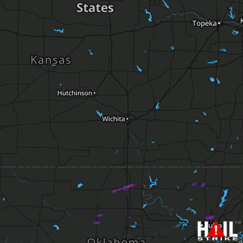 WICHITA (KICT) RADAR

