This weather event on May 17, 2025 includes:
4 states
17 counties,
23 cities,
and 54 zip codes.
There were 20760 total properties that were impacted and have possible damage.
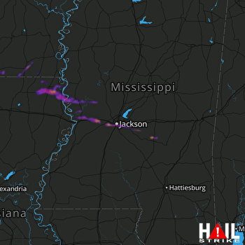 JACKSON (KDGX) RADAR
States Impacted By Hail On May 17, 2025
Alabama
·
Arkansas
·
Louisiana
·
Mississippi
Counties Impacted By Hail On May 17, 2025
Wilcox, AL
·
Ashley, AR
·
Bradley, AR
·
Union, AR
·
East Carroll, LA
·
Morehouse, LA
·
Union, LA
·
West Carroll, LA
·
Hinds, MS
·
Issaquena, MS
·
Jasper, MS
·
Madison, MS
·
Rankin, MS
·
Sharkey, MS
·
Smith, MS
·
Warren, MS
·
Yazoo, MS
Cities Impacted By Hail On May 17, 2025
Beechwood, MS
·
Bolton, MS
·
Brandon, MS
·
Byram, MS
·
Clinton, MS
·
Edwards, MS
·
Felsenthal, AR
·
Flowood, MS
·
Forest, LA
·
Huttig, AR
·
Jackson, MS
·
Lake Providence, LA
·
Pearl, MS
·
Pine Hill, AL
·
Pioneer, LA
·
Polkville, MS
·
Raleigh, MS
·
Raymond, MS
·
Richland, MS
·
Robinhood, MS
·
Sylvarena, MS
·
Vicksburg, MS
·
Wilmot, AR
Zip Codes Impacted By Hail On May 17, 2025
36722
·
36751
·
36769
·
36784
·
39040
·
39041
·
39042
·
39056
·
39066
·
39071
·
39073
·
39088
·
39117
·
39145
·
39152
·
39153
·
39156
·
39159
·
39162
·
39175
·
39177
·
39180
·
39183
·
39194
·
39201
·
39203
·
39204
·
39208
·
39209
·
39212
·
39218
·
39232
·
39338
·
71220
·
71223
·
71250
·
71254
·
71260
·
71263
·
71266
·
71276
·
71286
·
71635
·
71646
·
71647
·
71651
·
71658
·
71661
·
71676
·
71747
·
71765
·
39272
·
39193
·
39154

