This weather event on May 6, 2025 includes:
2 states
25 counties,
21 cities,
and 61 zip codes.
There were 197 total properties that were impacted and have possible damage.
States Impacted By Hail On May 6, 2025
Oklahoma
·
Texas
Counties Impacted By Hail On May 6, 2025
Carter, OK
·
Jackson, OK
·
Archer, TX
·
Baylor, TX
·
Callahan, TX
·
Clay, TX
·
Collin, TX
·
Denton, TX
·
Eastland, TX
·
Fisher, TX
·
Foard, TX
·
Grayson, TX
·
Hardeman, TX
·
Jack, TX
·
King, TX
·
Knox, TX
·
Montague, TX
·
Parker, TX
·
Shackelford, TX
·
Stephens, TX
·
Stonewall, TX
·
Tarrant, TX
·
Throckmorton, TX
·
Wilbarger, TX
·
Young, TX
Cities Impacted By Hail On May 6, 2025
Albany, TX
·
Argyle, TX
·
Baird, TX
·
Bartonville, TX
·
Benbrook, TX
·
Bowie, TX
·
Celina, TX
·
Clyde, TX
·
Denton, TX
·
Graham, TX
·
Gunter, TX
·
Haltom City, TX
·
Keller, TX
·
Lantana, TX
·
Moran, TX
·
North Richland Hills, TX
·
Saginaw, TX
·
Southlake, TX
·
Trophy Club, TX
·
Watauga, TX
·
Westlake, TX
Zip Codes Impacted By Hail On May 6, 2025
73401
·
73458
·
73560
·
75009
·
75058
·
76020
·
76085
·
76092
·
76106
·
76116
·
76117
·
76126
·
76137
·
76148
·
76182
·
76201
·
76205
·
76207
·
76208
·
76209
·
76210
·
76226
·
76227
·
76228
·
76230
·
76259
·
76262
·
76266
·
76351
·
76365
·
76370
·
76372
·
76374
·
76379
·
76380
·
76384
·
76389
·
76424
·
76430
·
76445
·
76448
·
76450
·
76454
·
76458
·
76460
·
76464
·
76466
·
76470
·
76475
·
76481
·
76483
·
76491
·
79225
·
79227
·
79236
·
79252
·
79502
·
79504
·
79510
·
79546
·
79601
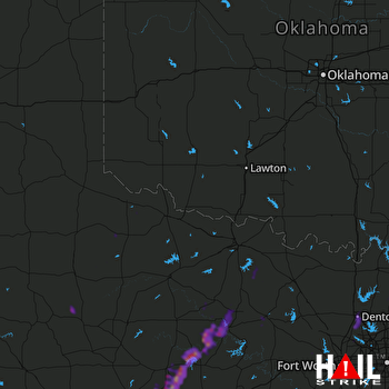 ALTUS AFB (KFDR) RADAR

