This weather event on May 4, 2025 includes:
2 states
24 counties,
17 cities,
and 67 zip codes.
There were 916 total properties that were impacted and have possible damage.
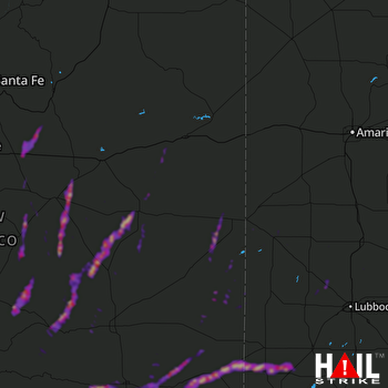 CANNON AFB (KFDX) RADAR
States Impacted By Hail On May 4, 2025
New Mexico
·
Texas
Counties Impacted By Hail On May 4, 2025
Chaves, NM
·
Curry, NM
·
De Baca, NM
·
Eddy, NM
·
Guadalupe, NM
·
Lea, NM
·
Lincoln, NM
·
Otero, NM
·
Quay, NM
·
Roosevelt, NM
·
San Miguel, NM
·
Santa Fe, NM
·
Socorro, NM
·
Torrance, NM
·
Bailey, TX
·
Cochran, TX
·
Gaines, TX
·
Hale, TX
·
Hockley, TX
·
Lamb, TX
·
Lubbock, TX
·
Parmer, TX
·
Terry, TX
·
Yoakum, TX
Cities Impacted By Hail On May 4, 2025
Anton, TX
·
Artesia, NM
·
Atoka, NM
·
Cannon AFB, NM
·
Capitan, NM
·
Corona, NM
·
Denver City, TX
·
Duran, NM
·
Fort Sumner, NM
·
Hope, NM
·
Indian Hills, NM
·
Lovington, NM
·
Muleshoe, TX
·
Nogal, NM
·
Portales, NM
·
Seagraves, TX
·
Villanueva, NM
Zip Codes Impacted By Hail On May 4, 2025
79031
·
79041
·
79064
·
79250
·
79311
·
79313
·
79314
·
79323
·
79324
·
79325
·
79336
·
79346
·
79347
·
79355
·
79359
·
79367
·
79378
·
79407
·
87011
·
87015
·
87016
·
87035
·
87056
·
87560
·
87569
·
87583
·
87701
·
88101
·
88103
·
88113
·
88114
·
88116
·
88119
·
88121
·
88124
·
88125
·
88126
·
88130
·
88132
·
88134
·
88136
·
88201
·
88203
·
88210
·
88240
·
88250
·
88254
·
88255
·
88260
·
88262
·
88264
·
88301
·
88316
·
88318
·
88321
·
88336
·
88339
·
88340
·
88351
·
88353
·
88401
·
88421
·
88427
·
88435
·
88341
·
88267
·
79363

