This weather event on April 29, 2025 includes:
2 states
24 counties,
29 cities,
and 82 zip codes.
There were 852 total properties that were impacted and have possible damage.
States Impacted By Hail On April 29, 2025
Kansas
·
Oklahoma
Counties Impacted By Hail On April 29, 2025
Barber, KS
·
Clark, KS
·
Comanche, KS
·
Ford, KS
·
Alfalfa, OK
·
Blaine, OK
·
Creek, OK
·
Ellis, OK
·
Garfield, OK
·
Grant, OK
·
Harper, OK
·
Kingfisher, OK
·
Lincoln, OK
·
Logan, OK
·
Major, OK
·
Noble, OK
·
Oklahoma, OK
·
Osage, OK
·
Pawnee, OK
·
Payne, OK
·
Rogers, OK
·
Tulsa, OK
·
Woods, OK
·
Woodward, OK
Cities Impacted By Hail On April 29, 2025
Arcadia, OK
·
Bison, OK
·
Breckenridge, OK
·
Coyle, OK
·
Cushing, OK
·
Edmond, OK
·
Enid, OK
·
Fort Supply, OK
·
Garber, OK
·
Guthrie, OK
·
Langston, OK
·
Limestone, OK
·
Meno, OK
·
Meridian, OK
·
Minneola, KS
·
Morrison, OK
·
Oklahoma City, OK
·
Owasso, OK
·
Perry, OK
·
Ringwood, OK
·
Sand Springs, OK
·
Stillwater, OK
·
Terlton, OK
·
Tryon, OK
·
Tulsa, OK
·
Turley, OK
·
Valley Park, OK
·
Waukomis, OK
·
Westport, OK
Zip Codes Impacted By Hail On April 29, 2025
67029
·
67057
·
67155
·
67865
·
73003
·
73007
·
73012
·
73013
·
73025
·
73027
·
73044
·
73049
·
73050
·
73054
·
73058
·
73061
·
73077
·
73131
·
73151
·
73703
·
73705
·
73717
·
73718
·
73719
·
73720
·
73722
·
73733
·
73736
·
73738
·
73739
·
73742
·
73747
·
73754
·
73759
·
73760
·
73763
·
73766
·
73768
·
73773
·
73801
·
73834
·
73840
·
73841
·
73842
·
73848
·
73860
·
74015
·
74017
·
74019
·
74021
·
74023
·
74032
·
74038
·
74055
·
74058
·
74059
·
74062
·
74063
·
74073
·
74074
·
74075
·
74081
·
74106
·
74107
·
74110
·
74115
·
74117
·
74126
·
74127
·
74130
·
74643
·
74650
·
74824
·
74832
·
74875
·
74881
·
73034
·
73701
·
73730
·
74085
·
74116
·
74640
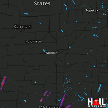 WICHITA (KICT) RADAR

