This weather event on October 21, 2024 includes:
3 states
21 counties,
15 cities,
and 72 zip codes.
There were 1053 total properties that were impacted and have possible damage.
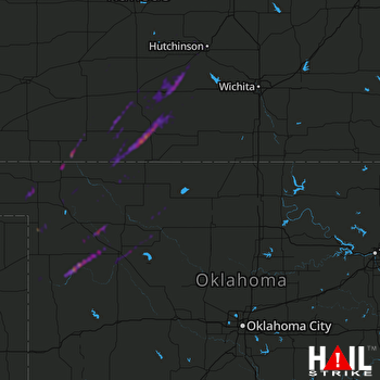 VANCE AFB (KVNX) RADAR
States Impacted By Hail On October 21, 2024
Kansas
·
Oklahoma
·
Texas
Counties Impacted By Hail On October 21, 2024
Barber, KS
·
Clark, KS
·
Comanche, KS
·
Edwards, KS
·
Harper, KS
·
Kingman, KS
·
Kiowa, KS
·
Pratt, KS
·
Reno, KS
·
Rice, KS
·
Stafford, KS
·
Alfalfa, OK
·
Beaver, OK
·
Dewey, OK
·
Ellis, OK
·
Harper, OK
·
Major, OK
·
Roger Mills, OK
·
Woods, OK
·
Woodward, OK
·
Hemphill, TX
Cities Impacted By Hail On October 21, 2024
Alva, OK
·
Arlington, KS
·
Carmen, OK
·
Coldwater, KS
·
Cunningham, KS
·
Freedom, OK
·
Hutchinson, KS
·
Medicine Lodge, KS
·
Nashville, KS
·
Penalosa, KS
·
Pratt, KS
·
Seiling, OK
·
Sharon, OK
·
Vici, OK
·
Zenda, KS
Zip Codes Impacted By Hail On October 21, 2024
67028
·
67578
·
67009
·
67029
·
67035
·
67054
·
67057
·
67058
·
67059
·
67061
·
67065
·
67066
·
67068
·
67070
·
67071
·
67104
·
67112
·
67124
·
67127
·
67134
·
67138
·
67142
·
67143
·
67155
·
67159
·
67501
·
67502
·
67510
·
67512
·
67514
·
67519
·
67545
·
67552
·
67557
·
67561
·
67566
·
67568
·
67573
·
67576
·
67579
·
67583
·
67831
·
73638
·
73642
·
73654
·
73663
·
73667
·
73716
·
73717
·
73726
·
73728
·
73729
·
73731
·
73737
·
73741
·
73801
·
73832
·
73834
·
73835
·
73838
·
73842
·
73843
·
73844
·
73848
·
73852
·
73853
·
73855
·
73857
·
73858
·
73859
·
73860
·
79014

