This weather event on September 15, 2024 includes:
1 states
20 counties,
18 cities,
and 57 zip codes.
There were 31 total properties that were impacted and have possible damage.
States Impacted By Hail On September 15, 2024
Kansas
Counties Impacted By Hail On September 15, 2024
Barton, KS
·
Ellsworth, KS
·
Gove, KS
·
Graham, KS
·
Greeley, KS
·
Hamilton, KS
·
Lincoln, KS
·
Logan, KS
·
Mitchell, KS
·
Norton, KS
·
Osborne, KS
·
Phillips, KS
·
Rush, KS
·
Russell, KS
·
Scott, KS
·
Sheridan, KS
·
Smith, KS
·
Thomas, KS
·
Trego, KS
·
Wichita, KS
Cities Impacted By Hail On September 15, 2024
Beverly, KS
·
Cedar, KS
·
Collyer, KS
·
Downs, KS
·
Gaylord, KS
·
Glade, KS
·
Gove City, KS
·
Grainfield, KS
·
Greeley County unified government (balance), KS
·
Kirwin, KS
·
Lincoln Center, KS
·
Marienthal, KS
·
Oakley, KS
·
Park, KS
·
Phillipsburg, KS
·
Portis, KS
·
Quinter, KS
·
Wilson, KS
Zip Codes Impacted By Hail On September 15, 2024
66932
·
66951
·
66967
·
67418
·
67420
·
67423
·
67430
·
67437
·
67446
·
67452
·
67455
·
67473
·
67474
·
67481
·
67484
·
67485
·
67490
·
67530
·
67544
·
67548
·
67622
·
67625
·
67628
·
67631
·
67638
·
67639
·
67640
·
67642
·
67644
·
67645
·
67646
·
67650
·
67654
·
67658
·
67659
·
67661
·
67665
·
67672
·
67673
·
67701
·
67736
·
67737
·
67738
·
67740
·
67748
·
67751
·
67752
·
67753
·
67761
·
67764
·
67861
·
67871
·
67878
·
67879
·
67863
·
67747
·
67439
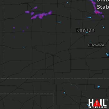 DODGE CITY (KDDC) RADAR

