This weather event on August 25, 2024 includes:
4 states
32 counties,
14 cities,
and 73 zip codes.
There were 354 total properties that were impacted and have possible damage.
States Impacted By Hail On August 25, 2024
Colorado
·
Kansas
·
Oklahoma
·
Texas
Counties Impacted By Hail On August 25, 2024
Baca, CO
·
Prowers, CO
·
Barber, KS
·
Clark, KS
·
Comanche, KS
·
Edwards, KS
·
Ellis, KS
·
Ford, KS
·
Gray, KS
·
Hamilton, KS
·
Kearny, KS
·
Kiowa, KS
·
Lane, KS
·
Meade, KS
·
Ness, KS
·
Scott, KS
·
Seward, KS
·
Stafford, KS
·
Stanton, KS
·
Trego, KS
·
Beaver, OK
·
Cimarron, OK
·
Ellis, OK
·
Harper, OK
·
Texas, OK
·
Woods, OK
·
Woodward, OK
·
Hansford, TX
·
Hutchinson, TX
·
Lipscomb, TX
·
Ochiltree, TX
·
Sherman, TX
Cities Impacted By Hail On August 25, 2024
Buffalo, OK
·
Coldwater, KS
·
Darrouzett, TX
·
Englewood, KS
·
Follett, TX
·
Forgan, OK
·
Fowler, KS
·
Hays, KS
·
Knowles, OK
·
Laverne, OK
·
Mullinville, KS
·
Perryton, TX
·
Syracuse, KS
·
Turpin, OK
Zip Codes Impacted By Hail On August 25, 2024
67054
·
67059
·
67071
·
67104
·
67109
·
67127
·
67143
·
67518
·
67519
·
67547
·
67552
·
67557
·
67560
·
67563
·
67572
·
67584
·
67601
·
67801
·
67831
·
67834
·
67839
·
67840
·
67841
·
67842
·
67844
·
67850
·
67857
·
67859
·
67860
·
67862
·
67864
·
67865
·
67871
·
67878
·
67901
·
73717
·
73801
·
73834
·
73841
·
73842
·
73843
·
73844
·
73848
·
73855
·
73858
·
73901
·
73931
·
73932
·
73933
·
73938
·
73942
·
73944
·
73945
·
73947
·
73949
·
73950
·
79005
·
79024
·
79033
·
79034
·
79046
·
79056
·
79070
·
79081
·
79083
·
79084
·
79093
·
81047
·
81090
·
67028
·
67029
·
67155
·
73851
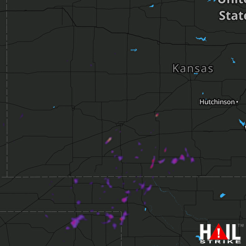 DODGE CITY (KDDC) RADAR

