This weather event on August 5, 2024 includes:
2 states
17 counties,
20 cities,
and 65 zip codes.
There were total properties that were impacted and have possible damage.
States Impacted By Hail On August 5, 2024
Iowa
·
Minnesota
Counties Impacted By Hail On August 5, 2024
Bremer, IA
·
Cerro Gordo, IA
·
Chickasaw, IA
·
Clayton, IA
·
Fayette, IA
·
Floyd, IA
·
Hancock, IA
·
Howard, IA
·
Mitchell, IA
·
Winnebago, IA
·
Winneshiek, IA
·
Worth, IA
·
Faribault, MN
·
Fillmore, MN
·
Freeborn, MN
·
Martin, MN
·
Mower, MN
Cities Impacted By Hail On August 5, 2024
Albert Lea, MN
·
Bolan, IA
·
Conger, MN
·
Crystal Lake, IA
·
Delavan, MN
·
Easton, MN
·
Emmons, MN
·
Frederika, IA
·
Grafton, IA
·
Kensett, IA
·
Maynard, IA
·
Nashua, IA
·
Northwood, IA
·
Roseville, IA
·
Sumner, IA
·
Twin Lakes, MN
·
Walters, MN
·
Wells, MN
·
Westgate, IA
·
Winnebago, MN
Zip Codes Impacted By Hail On August 5, 2024
50423
·
50432
·
50435
·
50436
·
50440
·
50448
·
50450
·
50456
·
50458
·
50459
·
50460
·
50461
·
50464
·
50468
·
50471
·
50472
·
50606
·
50607
·
50616
·
50645
·
50650
·
50655
·
50658
·
50659
·
50662
·
50666
·
50671
·
50674
·
50676
·
50681
·
52076
·
52136
·
52142
·
52155
·
52164
·
55909
·
55912
·
55917
·
55933
·
55936
·
55939
·
55951
·
55961
·
55970
·
55975
·
55977
·
56007
·
56009
·
56013
·
56014
·
56016
·
56020
·
56023
·
56025
·
56026
·
56033
·
56036
·
56045
·
56051
·
56068
·
56089
·
56097
·
56098
·
56029
·
50630
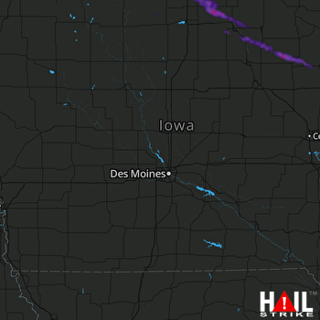 DES MOINES (KDMX) RADAR

