This weather event on July 16, 2024 includes:
3 states
23 counties,
25 cities,
and 75 zip codes.
There were total properties that were impacted and have possible damage.
States Impacted By Hail On July 16, 2024
Kansas
·
Missouri
·
Nebraska
Counties Impacted By Hail On July 16, 2024
Atchison, KS
·
Brown, KS
·
Clay, KS
·
Cloud, KS
·
Doniphan, KS
·
Jackson, KS
·
Jefferson, KS
·
Marshall, KS
·
Nemaha, KS
·
Pottawatomie, KS
·
Riley, KS
·
Washington, KS
·
Andrew, MO
·
Buchanan, MO
·
Clinton, MO
·
DeKalb, MO
·
Holt, MO
·
Nodaway, MO
·
Platte, MO
·
Franklin, NE
·
Greeley, NE
·
Richardson, NE
·
Webster, NE
Cities Impacted By Hail On July 16, 2024
Agency, MO
·
Atchison, KS
·
Belvue, KS
·
Bigelow, MO
·
De Kalb, MO
·
Delia, KS
·
Easton, MO
·
Elwood, KS
·
Emmett, KS
·
Highland, KS
·
Huron, KS
·
Lancaster, KS
·
Leonardville, KS
·
Lewis and Clark Village, MO
·
Louisville, KS
·
Manhattan, KS
·
Mayetta, KS
·
Mound City, MO
·
Nortonville, KS
·
Riley, KS
·
Rushville, MO
·
Soldier, KS
·
Stewartsville, MO
·
St. Joseph, MO
·
Wamego, KS
Zip Codes Impacted By Hail On July 16, 2024
64430
·
64436
·
64437
·
64440
·
64443
·
64448
·
64451
·
64454
·
64466
·
64473
·
64484
·
64487
·
64490
·
64501
·
64503
·
64504
·
64505
·
64506
·
64507
·
66002
·
66008
·
66016
·
66017
·
66023
·
66024
·
66035
·
66041
·
66060
·
66087
·
66088
·
66090
·
66094
·
66407
·
66411
·
66416
·
66418
·
66419
·
66422
·
66424
·
66428
·
66432
·
66436
·
66439
·
66440
·
66449
·
66503
·
66509
·
66512
·
66520
·
66521
·
66531
·
66532
·
66536
·
66540
·
66547
·
66548
·
66549
·
66554
·
66933
·
66945
·
67432
·
67466
·
68355
·
68431
·
68665
·
68842
·
68928
·
68930
·
68932
·
68970
·
66535
·
66502
·
64470
·
64401
·
64098
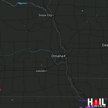 OMAHA (KOAX) RADAR

