This weather event on May 23, 2024 includes:
3 states
33 counties,
14 cities,
and 70 zip codes.
There were total properties that were impacted and have possible damage.
States Impacted By Hail On May 23, 2024
Kentucky
·
North Carolina
·
Tennessee
Counties Impacted By Hail On May 23, 2024
Adair, KY
·
Anderson, KY
·
Bullitt, KY
·
Clinton, KY
·
Cumberland, KY
·
Franklin, KY
·
Green, KY
·
Hardin, KY
·
Hart, KY
·
Jefferson, KY
·
Larue, KY
·
Marion, KY
·
Metcalfe, KY
·
Monroe, KY
·
Pulaski, KY
·
Russell, KY
·
Shelby, KY
·
Spencer, KY
·
Taylor, KY
·
Wayne, KY
·
Woodford, KY
·
Avery, NC
·
Burke, NC
·
Caldwell, NC
·
Blount, TN
·
Clay, TN
·
Cocke, TN
·
Fentress, TN
·
Jefferson, TN
·
Morgan, TN
·
Overton, TN
·
Pickett, TN
·
Sevier, TN
Cities Impacted By Hail On May 23, 2024
Albany, KY
·
Allardt, TN
·
Baneberry, TN
·
Buffalo, KY
·
Burkesville, KY
·
Celina, TN
·
Columbia, KY
·
Grimsley, TN
·
Livingston, TN
·
Sonora, KY
·
Summersville, KY
·
Townsend, TN
·
Upton, KY
·
Walland, TN
Zip Codes Impacted By Hail On May 23, 2024
28611
·
28616
·
28645
·
28646
·
28655
·
28657
·
28662
·
37733
·
37821
·
37852
·
37862
·
37865
·
37878
·
37882
·
37886
·
37890
·
38504
·
38506
·
38541
·
38543
·
38549
·
38551
·
38554
·
38556
·
38565
·
38568
·
38570
·
38573
·
38575
·
38577
·
38580
·
38589
·
40009
·
40023
·
40046
·
40071
·
40076
·
40299
·
40342
·
40347
·
40601
·
42129
·
42151
·
42167
·
42544
·
42553
·
42602
·
42603
·
42629
·
42633
·
42642
·
42716
·
42717
·
42718
·
42722
·
42728
·
42733
·
42740
·
42743
·
42748
·
42753
·
42757
·
42758
·
42764
·
42765
·
42776
·
42782
·
42784
·
40065
·
38574
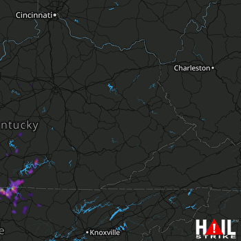 JACKSON (KJKL) RADAR

