This weather event on May 4, 2024 includes:
4 states
18 counties,
32 cities,
and 46 zip codes.
There were 1324 total properties that were impacted and have possible damage.
States Impacted By Hail On May 4, 2024
Arkansas
·
Kansas
·
Missouri
·
Oklahoma
Counties Impacted By Hail On May 4, 2024
Benton, AR
·
Carroll, AR
·
Labette, KS
·
Barry, MO
·
Barton, MO
·
Dade, MO
·
Jasper, MO
·
Lawrence, MO
·
McDonald, MO
·
Stone, MO
·
Creek, OK
·
Delaware, OK
·
Mayes, OK
·
Muskogee, OK
·
Okmulgee, OK
·
Rogers, OK
·
Tulsa, OK
·
Wagoner, OK
Cities Impacted By Hail On May 4, 2024
Altamont, KS
·
Beggs, OK
·
Bella Vista, AR
·
Bixby, OK
·
Broken Arrow, OK
·
Bull Hollow, OK
·
Chouteau, OK
·
Cloud Creek, OK
·
Coweta, OK
·
Deer Lick, OK
·
Dodge, OK
·
Glenpool, OK
·
Hoot Owl, OK
·
Jane, MO
·
Jenks, OK
·
Kenwood, OK
·
Kiefer, OK
·
Liberty, OK
·
Noel, MO
·
Porter, OK
·
Pryor Creek, OK
·
Pump Back, OK
·
Redbird, OK
·
Rose, OK
·
Salina, OK
·
Sapulpa, OK
·
Southwest City, MO
·
Spavinaw, OK
·
Sulphur Springs, AR
·
White Water, OK
·
Wickliffe, OK
·
Winchester, OK
Zip Codes Impacted By Hail On May 4, 2024
64748
·
64755
·
64836
·
64854
·
64856
·
64863
·
65604
·
65646
·
65707
·
65747
·
65752
·
67330
·
67356
·
67357
·
72616
·
72714
·
72715
·
72768
·
74008
·
74011
·
74014
·
74033
·
74036
·
74037
·
74041
·
74047
·
74066
·
74337
·
74338
·
74344
·
74346
·
74352
·
74361
·
74364
·
74365
·
74366
·
74401
·
74421
·
74428
·
74429
·
74436
·
74447
·
74450
·
74454
·
74458
·
74467
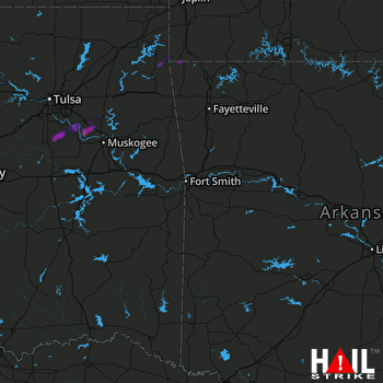 FORT SMITH (KSRX) RADAR

