This weather event on April 28, 2024 includes:
1 states
13 counties,
28 cities,
and 56 zip codes.
There were 1644 total properties that were impacted and have possible damage.
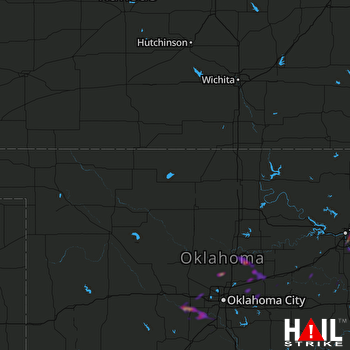 VANCE AFB (KVNX) RADAR
States Impacted By Hail On April 28, 2024
Oklahoma
Counties Impacted By Hail On April 28, 2024
Canadian, OK
·
Creek, OK
·
Grady, OK
·
Lincoln, OK
·
Logan, OK
·
McClain, OK
·
Oklahoma, OK
·
Okmulgee, OK
·
Payne, OK
·
Pottawatomie, OK
·
Rogers, OK
·
Tulsa, OK
·
Wagoner, OK
Cities Impacted By Hail On April 28, 2024
Beggs, OK
·
Bixby, OK
·
Blanchard, OK
·
Bridge Creek, OK
·
Broken Arrow, OK
·
Collinsville, OK
·
Edmond, OK
·
El Reno, OK
·
Fair Oaks, OK
·
Fallis, OK
·
Glenpool, OK
·
Guthrie, OK
·
Harrah, OK
·
Jenks, OK
·
Jones, OK
·
Langston, OK
·
Luther, OK
·
Meridian, OK
·
Minco, OK
·
Newcastle, OK
·
Oklahoma City, OK
·
Owasso, OK
·
Tulsa, OK
·
Tuttle, OK
·
Union City, OK
·
Warwick, OK
·
Wellston, OK
·
Yukon, OK
Zip Codes Impacted By Hail On April 28, 2024
73007
·
73010
·
73016
·
73020
·
73025
·
73027
·
73036
·
73044
·
73045
·
73049
·
73050
·
73054
·
73058
·
73059
·
73064
·
73090
·
73099
·
74008
·
74010
·
74011
·
74012
·
74014
·
74015
·
74021
·
74028
·
74033
·
74037
·
74053
·
74055
·
74080
·
74104
·
74105
·
74110
·
74112
·
74114
·
74115
·
74116
·
74117
·
74128
·
74129
·
74132
·
74133
·
74134
·
74135
·
74136
·
74137
·
74145
·
74146
·
74421
·
74447
·
74834
·
74851
·
74869
·
74881
·
73065
·
73089

