This weather event on October 28, 2026 includes:
2 states
19 counties,
21 cities,
and 56 zip codes.
There were 2972 total properties that were impacted and have possible damage.
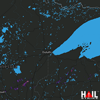 DULUTH (KDLH) RADAR
States Impacted By Hail On October 28, 2026
Minnesota
·
Wisconsin
Counties Impacted By Hail On October 28, 2026
Benton, MN
·
Carlton, MN
·
Chisago, MN
·
Isanti, MN
·
Kanabec, MN
·
Mille Lacs, MN
·
Morrison, MN
·
Pine, MN
·
Stearns, MN
·
St. Louis, MN
·
Wright, MN
·
Ashland, WI
·
Bayfield, WI
·
Burnett, WI
·
Douglas, WI
·
Iron, WI
·
Price, WI
·
Sawyer, WI
·
Washburn, WI
Cities Impacted By Hail On October 28, 2026
Butternut, WI
·
Cable, WI
·
Chief Lake, WI
·
Foley, MN
·
Gilman, MN
·
Mercer, WI
·
Mora, MN
·
Ogilvie, MN
·
Pease, MN
·
Quamba, MN
·
Rice Lake, MN
·
Rock Creek, MN
·
Rush City, MN
·
Sartell, MN
·
Sauk Rapids, MN
·
Spooner, WI
·
St. Cloud, MN
·
St. Joseph, MN
·
Stone Lake, WI
·
St. Stephen, MN
·
Trego, WI
Zip Codes Impacted By Hail On October 28, 2026
54514
·
54515
·
54527
·
54546
·
54547
·
54552
·
54555
·
54801
·
54820
·
54821
·
54832
·
54838
·
54839
·
54840
·
54843
·
54859
·
54870
·
54873
·
54874
·
54875
·
54876
·
54888
·
54896
·
55007
·
55008
·
55017
·
55030
·
55037
·
55051
·
55063
·
55069
·
55072
·
55080
·
55320
·
55371
·
55382
·
55712
·
55749
·
55756
·
55803
·
56303
·
56310
·
56329
·
56330
·
56338
·
56342
·
56353
·
56357
·
56358
·
56359
·
56363
·
56367
·
56374
·
56375
·
56377
·
56379