This weather event on June 20, 2026 includes:
2 states
18 counties,
18 cities,
and 59 zip codes.
There were 2410 total properties that were impacted and have possible damage.
States Impacted By Hail On June 20, 2026
Kansas
·
Nebraska
Counties Impacted By Hail On June 20, 2026
Brown, KS
·
Doniphan, KS
·
Franklin, KS
·
Kingman, KS
·
Marshall, KS
·
Nemaha, KS
·
Reno, KS
·
Republic, KS
·
Riley, KS
·
Sedgwick, KS
·
Stafford, KS
·
Wabaunsee, KS
·
Clay, NE
·
Gage, NE
·
Jefferson, NE
·
Nuckolls, NE
·
Pawnee, NE
·
Thayer, NE
Cities Impacted By Hail On June 20, 2026
Chester, NE
·
Clay Center, NE
·
Deshler, NE
·
Edgar, NE
·
Fairfield, NE
·
Fairview, KS
·
Goddard, KS
·
Hiawatha, KS
·
Highland, KS
·
Manhattan, KS
·
Munden, KS
·
Oak, NE
·
Penalosa, KS
·
Reynolds, NE
·
Robinson, KS
·
Sabetha, KS
·
Turon, KS
·
Wichita, KS
Zip Codes Impacted By Hail On June 20, 2026
68974
·
68964
·
68961
·
68944
·
68938
·
68935
·
68933
·
68452
·
68381
·
68377
·
68375
·
68370
·
68352
·
68342
·
68340
·
68335
·
68327
·
68326
·
68325
·
68310
·
67583
·
67578
·
67566
·
67545
·
67514
·
67510
·
67447
·
67212
·
67209
·
67205
·
67204
·
67203
·
67111
·
67068
·
67052
·
67035
·
66964
·
66960
·
66959
·
66940
·
66935
·
66554
·
66541
·
66538
·
66534
·
66532
·
66527
·
66515
·
66503
·
66502
·
66434
·
66425
·
66408
·
66404
·
66403
·
66401
·
66087
·
66067
·
66035
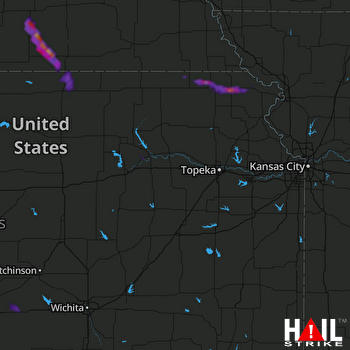 TOPEKA (KTWX) RADAR

