This weather event on June 13, 2026 includes:
2 states
23 counties,
16 cities,
and 63 zip codes.
There were 6477 total properties that were impacted and have possible damage.
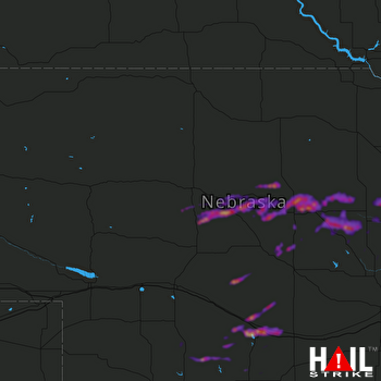 NORTH PLATTE (KLNX) RADAR
States Impacted By Hail On June 13, 2026
Kansas
·
Nebraska
Counties Impacted By Hail On June 13, 2026
Norton, KS
·
Antelope, NE
·
Blaine, NE
·
Boone, NE
·
Custer, NE
·
Dawson, NE
·
Frontier, NE
·
Furnas, NE
·
Garfield, NE
·
Gosper, NE
·
Greeley, NE
·
Hayes, NE
·
Howard, NE
·
Lincoln, NE
·
Logan, NE
·
Loup, NE
·
Madison, NE
·
Merrick, NE
·
Nance, NE
·
Platte, NE
·
Thomas, NE
·
Valley, NE
·
Wheeler, NE
Cities Impacted By Hail On June 13, 2026
Broken Bow, NE
·
Burwell, NE
·
Cozad, NE
·
Dunning, NE
·
Eddyville, NE
·
Elgin, NE
·
Elyria, NE
·
Farnam, NE
·
Lexington, NE
·
Ord, NE
·
Overton, NE
·
Primrose, NE
·
Sargent, NE
·
St. Edward, NE
·
Stockville, NE
·
Wolbach, NE
Zip Codes Impacted By Hail On June 13, 2026
68948
·
68637
·
67653
·
67622
·
69166
·
69163
·
69142
·
69138
·
69130
·
69046
·
69042
·
69039
·
69038
·
69029
·
69028
·
69025
·
69022
·
69001
·
68977
·
68976
·
68937
·
68936
·
68922
·
68882
·
68881
·
68879
·
68878
·
68875
·
68874
·
68873
·
68863
·
68862
·
68860
·
68859
·
68850
·
68842
·
68837
·
68834
·
68833
·
68828
·
68826
·
68825
·
68823
·
68822
·
68821
·
68814
·
68813
·
68781
·
68761
·
68752
·
68665
·
68660
·
68655
·
68652
·
68640
·
68638
·
68636
·
68628
·
68627
·
68623
·
68622
·
68620
·
67654

