This weather event on June 2, 2026 includes:
2 states
18 counties,
18 cities,
and 75 zip codes.
There were 186 total properties that were impacted and have possible damage.
States Impacted By Hail On June 2, 2026
Kansas
·
Nebraska
Counties Impacted By Hail On June 2, 2026
Clay, KS
·
Cloud, KS
·
Marshall, KS
·
Republic, KS
·
Washington, KS
·
Clay, NE
·
Fillmore, NE
·
Gage, NE
·
Hamilton, NE
·
Howard, NE
·
Jefferson, NE
·
Nance, NE
·
Platte, NE
·
Saline, NE
·
Sherman, NE
·
Thayer, NE
·
Valley, NE
·
York, NE
Cities Impacted By Hail On June 2, 2026
Alexandria, NE
·
Arcadia, NE
·
Barnes, KS
·
Belvidere, NE
·
Carleton, NE
·
Clyde, KS
·
Cuba, KS
·
Fairmont, NE
·
Geneva, NE
·
Greenleaf, KS
·
Harbine, NE
·
Hebron, NE
·
Home, KS
·
Hubbell, NE
·
Marysville, KS
·
Milligan, NE
·
Odell, NE
·
Strang, NE
Zip Codes Impacted By Hail On June 2, 2026
66406
·
66938
·
68415
·
68464
·
68979
·
68871
·
68869
·
68862
·
68853
·
68852
·
68843
·
68838
·
68835
·
68818
·
68815
·
68758
·
68663
·
68660
·
68647
·
68644
·
68640
·
68638
·
68466
·
68453
·
68445
·
68444
·
68440
·
68436
·
68424
·
68416
·
68406
·
68401
·
68377
·
68375
·
68371
·
68370
·
68365
·
68362
·
68361
·
68359
·
68354
·
68352
·
68351
·
68350
·
68342
·
68341
·
68338
·
68327
·
68326
·
68322
·
68319
·
68318
·
68315
·
68310
·
68303
·
66968
·
66962
·
66960
·
66959
·
66958
·
66955
·
66953
·
66946
·
66945
·
66943
·
66940
·
66937
·
66933
·
66901
·
66548
·
66508
·
66438
·
66427
·
66412
·
66411
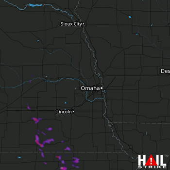 OMAHA (KOAX) RADAR

