This weather event on May 8, 2026 includes:
2 states
21 counties,
23 cities,
and 66 zip codes.
There were 5385 total properties that were impacted and have possible damage.
States Impacted By Hail On May 8, 2026
Louisiana
·
Texas
Counties Impacted By Hail On May 8, 2026
Beauregard, LA
·
Vernon, LA
·
Angelina, TX
·
Austin, TX
·
Brazos, TX
·
Fayette, TX
·
Grimes, TX
·
Houston, TX
·
Jasper, TX
·
Leon, TX
·
Madison, TX
·
Montgomery, TX
·
Newton, TX
·
Polk, TX
·
Robertson, TX
·
San Jacinto, TX
·
Trinity, TX
·
Tyler, TX
·
Walker, TX
·
Waller, TX
·
Washington, TX
Cities Impacted By Hail On May 8, 2026
Bedias, TX
·
Brenham, TX
·
Chester, TX
·
Colmesneil, TX
·
Conroe, TX
·
Corrigan, TX
·
DeRidder, LA
·
Groveton, TX
·
Huntsville, TX
·
Ivanhoe, TX
·
Jasper, TX
·
Madisonville, TX
·
Merryville, LA
·
Midway, TX
·
Montgomery, TX
·
New Waverly, TX
·
Normangee, TX
·
Oakhurst, TX
·
Pleasant Hill, TX
·
Point Blank, TX
·
Riverside, TX
·
Seven Oaks, TX
·
Westwood Shores, TX
Zip Codes Impacted By Hail On May 8, 2026
77867
·
75936
·
75856
·
70639
·
70634
·
78954
·
78950
·
78945
·
78944
·
78940
·
78931
·
77880
·
77872
·
77871
·
77868
·
77864
·
77859
·
77856
·
77835
·
77833
·
77831
·
77808
·
77807
·
77624
·
77484
·
77445
·
77426
·
77378
·
77367
·
77364
·
77363
·
77360
·
77359
·
77358
·
77356
·
77351
·
77340
·
77331
·
77320
·
77318
·
77316
·
75980
·
75979
·
75977
·
75966
·
75960
·
75956
·
75951
·
75949
·
75939
·
75938
·
75934
·
75932
·
75928
·
75926
·
75904
·
75901
·
75862
·
75852
·
75851
·
75850
·
75847
·
75845
·
75835
·
71446
·
70653
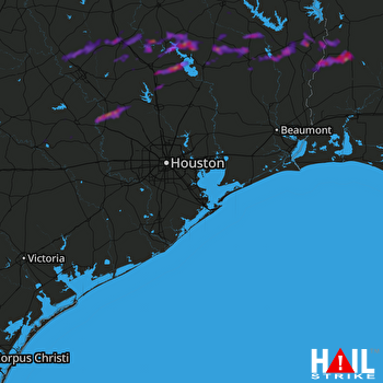 HOUSTON (KHGX) RADAR

