This weather event on April 29, 2026 includes:
3 states
26 counties,
18 cities,
and 56 zip codes.
There were 4566 total properties that were impacted and have possible damage.
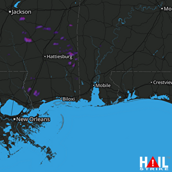 MOBILE (KMOB) RADAR
States Impacted By Hail On April 29, 2026
Alabama
·
Louisiana
·
Mississippi
Counties Impacted By Hail On April 29, 2026
Clarke, AL
·
Conecuh, AL
·
Mobile, AL
·
Monroe, AL
·
Washington, AL
·
St. Tammany, LA
·
Washington, LA
·
Clarke, MS
·
Covington, MS
·
Forrest, MS
·
George, MS
·
Greene, MS
·
Hancock, MS
·
Jasper, MS
·
Jefferson Davis, MS
·
Jones, MS
·
Lawrence, MS
·
Lincoln, MS
·
Pearl River, MS
·
Perry, MS
·
Pike, MS
·
Rankin, MS
·
Simpson, MS
·
Smith, MS
·
Walthall, MS
·
Wayne, MS
Cities Impacted By Hail On April 29, 2026
Bayou La Batre, AL
·
Bay Springs, MS
·
Buckatunna, MS
·
Clara, MS
·
Collins, MS
·
Hattiesburg, MS
·
Heidelberg, MS
·
Jackson, AL
·
Leakesville, MS
·
Lucedale, MS
·
Magee, MS
·
Mount Olive, MS
·
Picayune, MS
·
Poplarville, MS
·
Semmes, AL
·
State Line, MS
·
Sun, LA
·
Sylvarena, MS
Zip Codes Impacted By Hail On April 29, 2026
36587
·
39140
·
70463
·
70431
·
70427
·
39662
·
39641
·
39573
·
39556
·
39481
·
39476
·
39474
·
39470
·
39466
·
39464
·
39461
·
39456
·
39452
·
39451
·
39443
·
39439
·
39437
·
39428
·
39426
·
39422
·
39401
·
39367
·
39366
·
39362
·
39360
·
39356
·
39355
·
39347
·
39322
·
39168
·
39153
·
39145
·
39119
·
39116
·
39114
·
39111
·
39044
·
39042
·
36608
·
36582
·
36575
·
36545
·
36539
·
36524
·
36523
·
36522
·
36518
·
36509
·
36502
·
36451
·
36444

