This weather event on April 27, 2026 includes:
2 states
25 counties,
20 cities,
and 88 zip codes.
There were 3721 total properties that were impacted and have possible damage.
States Impacted By Hail On April 27, 2026
Oklahoma
·
Texas
Counties Impacted By Hail On April 27, 2026
Caddo, OK
·
Canadian, OK
·
Cleveland, OK
·
Grady, OK
·
Kingfisher, OK
·
Lincoln, OK
·
Logan, OK
·
Murray, OK
·
Oklahoma, OK
·
Stephens, OK
·
Archer, TX
·
Baylor, TX
·
Callahan, TX
·
Clay, TX
·
Eastland, TX
·
Fisher, TX
·
Foard, TX
·
Hardeman, TX
·
Haskell, TX
·
Jack, TX
·
Knox, TX
·
Shackelford, TX
·
Throckmorton, TX
·
Wilbarger, TX
·
Young, TX
Cities Impacted By Hail On April 27, 2026
Arcadia, OK
·
Bray, OK
·
Bridge Creek, OK
·
Chickasha, OK
·
Edmond, OK
·
El Reno, OK
·
Fallis, OK
·
Forest Park, OK
·
Hennessey, OK
·
Jones, OK
·
Lake Aluma, OK
·
Luther, OK
·
Midwest City, OK
·
Minco, OK
·
Mustang, OK
·
Oklahoma City, OK
·
Pocasset, OK
·
Tuttle, OK
·
Union City, OK
·
Verden, OK
Zip Codes Impacted By Hail On April 27, 2026
73141
·
73036
·
73005
·
73004
·
79601
·
79546
·
79533
·
79529
·
79521
·
79510
·
79505
·
79504
·
79252
·
79227
·
79225
·
76486
·
76483
·
76469
·
76464
·
76458
·
76450
·
76437
·
76430
·
76427
·
76389
·
76388
·
76384
·
76380
·
76374
·
76372
·
76371
·
76366
·
76365
·
76360
·
76351
·
74881
·
73762
·
73742
·
73734
·
73444
·
73179
·
73173
·
73169
·
73159
·
73151
·
73131
·
73128
·
73127
·
73121
·
73119
·
73118
·
73117
·
73116
·
73114
·
73112
·
73111
·
73109
·
73108
·
73107
·
73106
·
73105
·
73104
·
73103
·
73102
·
73097
·
73092
·
73090
·
73089
·
73084
·
73082
·
73079
·
73067
·
73064
·
73059
·
73058
·
73055
·
73054
·
73049
·
73047
·
73044
·
73042
·
73034
·
73030
·
73028
·
73018
·
73014
·
73013
·
73007
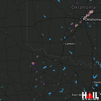 ALTUS AFB (KFDR) RADAR

