This weather event on April 14, 2026 includes:
2 states
23 counties,
19 cities,
and 57 zip codes.
There were 1338 total properties that were impacted and have possible damage.
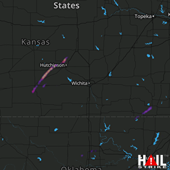 WICHITA (KICT) RADAR
States Impacted By Hail On April 14, 2026
Kansas
·
Oklahoma
Counties Impacted By Hail On April 14, 2026
Chautauqua, KS
·
Cloud, KS
·
Jewell, KS
·
Kingman, KS
·
McPherson, KS
·
Mitchell, KS
·
Montgomery, KS
·
Osborne, KS
·
Pratt, KS
·
Reno, KS
·
Republic, KS
·
Rice, KS
·
Stafford, KS
·
Washington, KS
·
Craig, OK
·
Creek, OK
·
Garfield, OK
·
Logan, OK
·
Noble, OK
·
Nowata, OK
·
Osage, OK
·
Rogers, OK
·
Tulsa, OK
Cities Impacted By Hail On April 14, 2026
Cawker City, KS
·
Coats, KS
·
Glenpool, OK
·
Havana, KS
·
Independence, KS
·
Jewell, KS
·
Kellyville, OK
·
Kiefer, OK
·
Mounds, OK
·
Oakhurst, OK
·
Perry, OK
·
Plevna, KS
·
Pratt, KS
·
Preston, KS
·
Randall, KS
·
Sand Springs, OK
·
Sapulpa, OK
·
Sylvia, KS
·
Tulsa, OK
Zip Codes Impacted By Hail On April 14, 2026
66948
·
74022
·
74066
·
74604
·
74301
·
74132
·
74131
·
74107
·
74063
·
74056
·
74050
·
74047
·
74041
·
74039
·
74033
·
74016
·
74010
·
73077
·
73073
·
73061
·
73056
·
67583
·
67581
·
67579
·
67578
·
67570
·
67568
·
67561
·
67546
·
67510
·
67502
·
67446
·
67437
·
67430
·
67420
·
67417
·
67360
·
67355
·
67347
·
67333
·
67301
·
67134
·
67124
·
67068
·
67066
·
67035
·
67028
·
66966
·
66963
·
66962
·
66949
·
66942
·
66939
·
66938
·
66937
·
66935
·
66901

