This weather event on April 14, 2026 includes:
1 states
28 counties,
17 cities,
and 49 zip codes.
There were 59 total properties that were impacted and have possible damage.
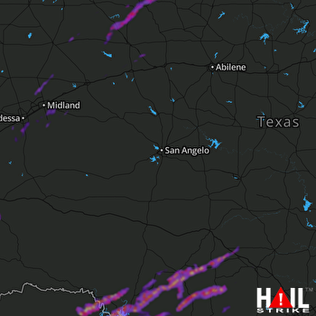 SAN ANGELO (KSJT) RADAR
States Impacted By Hail On April 14, 2026
Texas
Counties Impacted By Hail On April 14, 2026
Andrews, TX
·
Bandera, TX
·
Borden, TX
·
Crane, TX
·
Dawson, TX
·
Dickens, TX
·
Ector, TX
·
Edwards, TX
·
Fisher, TX
·
Garza, TX
·
Glasscock, TX
·
Howard, TX
·
Kent, TX
·
Kerr, TX
·
Kimble, TX
·
King, TX
·
Kinney, TX
·
Martin, TX
·
Midland, TX
·
Mitchell, TX
·
Pecos, TX
·
Real, TX
·
Scurry, TX
·
Stonewall, TX
·
Upton, TX
·
Uvalde, TX
·
Val Verde, TX
·
Ward, TX
Cities Impacted By Hail On April 14, 2026
Amistad, TX
·
Box Canyon, TX
·
Camp Wood, TX
·
Coahoma, TX
·
Del Rio, TX
·
Fort Clark Springs, TX
·
Girard, TX
·
Jayton, TX
·
Kerrville, TX
·
Lake View, TX
·
Laughlin AFB, TX
·
Leakey, TX
·
Midland, TX
·
Odessa, TX
·
Rocksprings, TX
·
Utopia, TX
·
West Odessa, TX
Zip Codes Impacted By Hail On April 14, 2026
79783
·
79782
·
79766
·
79763
·
79759
·
79756
·
79749
·
79738
·
79735
·
79731
·
79720
·
79706
·
79565
·
79549
·
79545
·
79528
·
79527
·
79526
·
79518
·
79517
·
79512
·
79511
·
79502
·
79370
·
79356
·
79351
·
79331
·
79330
·
79236
·
78885
·
78884
·
78881
·
78880
·
78873
·
78843
·
78840
·
78837
·
78833
·
78832
·
78828
·
78801
·
78631
·
78058
·
78055
·
78028
·
78025
·
78024
·
76950
·
76849

