This weather event on April 12, 2026 includes:
2 states
15 counties,
31 cities,
and 69 zip codes.
There were total properties that were impacted and have possible damage.
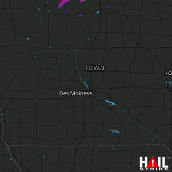 DES MOINES (KDMX) RADAR
States Impacted By Hail On April 12, 2026
Iowa
·
Minnesota
Counties Impacted By Hail On April 12, 2026
Cerro Gordo, IA
·
Emmet, IA
·
Floyd, IA
·
Hancock, IA
·
Howard, IA
·
Humboldt, IA
·
Kossuth, IA
·
Mitchell, IA
·
Winnebago, IA
·
Worth, IA
·
Faribault, MN
·
Fillmore, MN
·
Freeborn, MN
·
Martin, MN
·
Mower, MN
Cities Impacted By Hail On April 12, 2026
Albert Lea, MN
·
Bancroft, IA
·
Blue Earth, MN
·
Bricelyn, MN
·
Britt, IA
·
Burt, IA
·
Chester, IA
·
Clear Lake, IA
·
Conger, MN
·
Corwith, IA
·
Easton, MN
·
Elmore, MN
·
Fenton, IA
·
Freeborn, MN
·
Frost, MN
·
Hutchins, IA
·
Lakota, IA
·
Ledyard, IA
·
Mason City, IA
·
Minnesota Lake, MN
·
Osage, IA
·
Plymouth, IA
·
Scarville, IA
·
Sexton, IA
·
St. Benedict, IA
·
Swea City, IA
·
Thompson, IA
·
Titonka, IA
·
Ventura, IA
·
Wells, MN
·
Wesley, IA
Zip Codes Impacted By Hail On April 12, 2026
56014
·
50598
·
56097
·
56072
·
56068
·
56051
·
56043
·
56042
·
56039
·
56036
·
56033
·
56032
·
56029
·
56027
·
56025
·
56023
·
56020
·
56013
·
56009
·
56007
·
55951
·
52155
·
52134
·
50628
·
50590
·
50582
·
50578
·
50560
·
50559
·
50556
·
50539
·
50522
·
50520
·
50519
·
50517
·
50514
·
50511
·
50483
·
50482
·
50480
·
50478
·
50477
·
50476
·
50473
·
50471
·
50469
·
50466
·
50465
·
50464
·
50461
·
50460
·
50459
·
50458
·
50456
·
50455
·
50454
·
50453
·
50451
·
50450
·
50447
·
50440
·
50438
·
50436
·
50435
·
50430
·
50428
·
50424
·
50423
·
50401

