This weather event on April 5, 2026 includes:
2 states
22 counties,
26 cities,
and 73 zip codes.
There were 1357 total properties that were impacted and have possible damage.
States Impacted By Hail On April 5, 2026
North Carolina
·
South Carolina
Counties Impacted By Hail On April 5, 2026
Beaufort, NC
·
Bertie, NC
·
Bladen, NC
·
Brunswick, NC
·
Camden, NC
·
Columbus, NC
·
Craven, NC
·
Currituck, NC
·
Dare, NC
·
Duplin, NC
·
Jones, NC
·
Martin, NC
·
Onslow, NC
·
Pamlico, NC
·
Pasquotank, NC
·
Pender, NC
·
Perquimans, NC
·
Pitt, NC
·
Sampson, NC
·
Tyrrell, NC
·
Washington, NC
·
Horry, SC
Cities Impacted By Hail On April 5, 2026
Atkinson, NC
·
Belhaven, NC
·
Chadbourn, NC
·
Conway, SC
·
Cove City, NC
·
Creswell, NC
·
Half Moon, NC
·
Hallsboro, NC
·
Ivanhoe, NC
·
Jacksonville, NC
·
Kelly, NC
·
Navassa, NC
·
Northwest, NC
·
Piney Green, NC
·
Potters Hill, NC
·
Pumpkin Center, NC
·
Red Hill, SC
·
Riegelwood, NC
·
River Road, NC
·
Sandyfield, NC
·
Teachey, NC
·
Vanceboro, NC
·
Wallace, NC
·
Washington, NC
·
Watha, NC
·
Winfall, NC
Zip Codes Impacted By Hail On April 5, 2026
29569
·
29568
·
29545
·
29527
·
29526
·
28586
·
28585
·
28574
·
28573
·
28572
·
28562
·
28560
·
28555
·
28547
·
28546
·
28544
·
28543
·
28540
·
28532
·
28530
·
28527
·
28526
·
28523
·
28521
·
28518
·
28478
·
28472
·
28467
·
28466
·
28464
·
28463
·
28457
·
28456
·
28455
·
28451
·
28450
·
28448
·
28447
·
28444
·
28442
·
28441
·
28436
·
28435
·
28434
·
28433
·
28432
·
28431
·
28425
·
28423
·
28421
·
28420
·
28337
·
27983
·
27974
·
27973
·
27970
·
27957
·
27953
·
27944
·
27928
·
27927
·
27925
·
27921
·
27909
·
27892
·
27889
·
27865
·
27860
·
27846
·
27817
·
27814
·
27810
·
27806
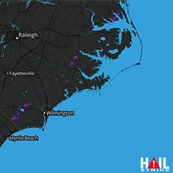 MOREHEAD CITY (KMHX) RADAR

