This weather event on October 24, 2025 includes:
1 states
31 counties,
11 cities,
and 66 zip codes.
There were 5751 total properties that were impacted and have possible damage.
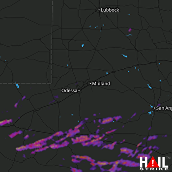 MIDLAND/ODSSA (KMAF) RADAR
States Impacted By Hail On October 24, 2025
Texas
Counties Impacted By Hail On October 24, 2025
Andrews, TX
·
Bailey, TX
·
Brewster, TX
·
Crane, TX
·
Crockett, TX
·
Culberson, TX
·
Ector, TX
·
Garza, TX
·
Glasscock, TX
·
Hale, TX
·
Irion, TX
·
Jeff Davis, TX
·
Kent, TX
·
Lamb, TX
·
Loving, TX
·
Menard, TX
·
Midland, TX
·
Pecos, TX
·
Presidio, TX
·
Reagan, TX
·
Reeves, TX
·
Runnels, TX
·
Schleicher, TX
·
Sterling, TX
·
Sutton, TX
·
Terrell, TX
·
Tom Green, TX
·
Upton, TX
·
Val Verde, TX
·
Ward, TX
·
Winkler, TX
Cities Impacted By Hail On October 24, 2025
Fort Davis, TX
·
Fort Stockton, TX
·
Gardendale, TX
·
Iraan, TX
·
McCamey, TX
·
Midland, TX
·
Monahans, TX
·
Pecos, TX
·
San Angelo, TX
·
Sanderson, TX
·
Sonora, TX
Zip Codes Impacted By Hail On October 24, 2025
76930
·
76932
·
76935
·
76936
·
76941
·
76943
·
76950
·
76951
·
76958
·
78837
·
78840
·
78851
·
78871
·
79041
·
79311
·
79312
·
79313
·
79324
·
79326
·
79330
·
79339
·
79346
·
79347
·
79356
·
79369
·
79371
·
79528
·
79703
·
79707
·
79718
·
79731
·
79734
·
79735
·
79739
·
79780
·
79781
·
79785
·
79830
·
79831
·
79842
·
79843
·
79848
·
79942
·
79855
·
79778
·
79777
·
79772
·
79762
·
79759
·
79758
·
79756
·
79755
·
79754
·
79752
·
79745
·
79744
·
79743
·
79741
·
79549
·
76905
·
76904
·
76901
·
76861
·
76859
·
76841
·
76821

