This weather event on October 18, 2025 includes:
2 states
19 counties,
30 cities,
and 72 zip codes.
There were 2368 total properties that were impacted and have possible damage.
States Impacted By Hail On October 18, 2025
Kansas
·
Oklahoma
Counties Impacted By Hail On October 18, 2025
Chautauqua, KS
·
Montgomery, KS
·
Canadian, OK
·
Cleveland, OK
·
Comanche, OK
·
Creek, OK
·
Grady, OK
·
Kay, OK
·
Lincoln, OK
·
Logan, OK
·
McClain, OK
·
Noble, OK
·
Oklahoma, OK
·
Osage, OK
·
Pawnee, OK
·
Payne, OK
·
Rogers, OK
·
Tulsa, OK
·
Washington, OK
Cities Impacted By Hail On October 18, 2025
Bushyhead, OK
·
Caney, KS
·
Catoosa, OK
·
Coffeyville, KS
·
Copan, OK
·
Edmond, OK
·
Fallis, OK
·
Glencoe, OK
·
Glenpool, OK
·
Havana, KS
·
Independence, KS
·
Jenks, OK
·
Jennings, OK
·
Kiefer, OK
·
McCord, OK
·
Minco, OK
·
Mounds, OK
·
Newcastle, OK
·
Oklahoma City, OK
·
Owasso, OK
·
Pawnee, OK
·
Peru, KS
·
Shidler, OK
·
Skedee, OK
·
Skiatook, OK
·
Tryon, OK
·
Tulsa, OK
·
Tuttle, OK
·
Union City, OK
·
Yukon, OK
Zip Codes Impacted By Hail On October 18, 2025
74881
·
74875
·
74832
·
74652
·
74651
·
74650
·
74644
·
74637
·
74633
·
74604
·
74137
·
74116
·
74085
·
74084
·
74083
·
74081
·
74075
·
74074
·
74059
·
74058
·
74056
·
74055
·
74047
·
74045
·
74041
·
74038
·
74037
·
74035
·
74033
·
74032
·
74022
·
74020
·
74019
·
74017
·
74015
·
74008
·
74002
·
73538
·
73179
·
73173
·
73169
·
73162
·
73159
·
73142
·
73132
·
73119
·
73108
·
73099
·
73090
·
73089
·
73078
·
73065
·
73064
·
73061
·
73059
·
73058
·
73054
·
73036
·
73013
·
73012
·
73007
·
73006
·
67364
·
67361
·
67360
·
67355
·
67351
·
67347
·
67337
·
67335
·
67333
·
67301
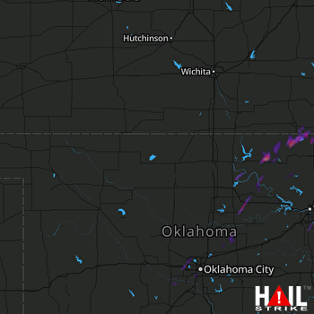 VANCE AFB (KVNX) RADAR

