This weather event on October 17, 2025 includes:
3 states
28 counties,
20 cities,
and 80 zip codes.
There were 1249 total properties that were impacted and have possible damage.
States Impacted By Hail On October 17, 2025
Iowa
·
Kansas
·
Missouri
Counties Impacted By Hail On October 17, 2025
Decatur, IA
·
Chase, KS
·
Douglas, KS
·
Franklin, KS
·
Jackson, KS
·
Jefferson, KS
·
Johnson, KS
·
Leavenworth, KS
·
Lyon, KS
·
Nemaha, KS
·
Osage, KS
·
Wyandotte, KS
·
Andrew, MO
·
Buchanan, MO
·
Caldwell, MO
·
Daviess, MO
·
DeKalb, MO
·
Gentry, MO
·
Grundy, MO
·
Harrison, MO
·
Linn, MO
·
Mercer, MO
·
Nodaway, MO
·
Platte, MO
·
Putnam, MO
·
Ray, MO
·
Sullivan, MO
·
Worth, MO
Cities Impacted By Hail On October 17, 2025
Albany, MO
·
Bethany, MO
·
Burlingame, KS
·
Clarksdale, MO
·
Emporia, KS
·
Jameson, MO
·
Lake Viking, MO
·
Lawrence, KS
·
Lecompton, KS
·
Maysville, MO
·
McFall, MO
·
New Hampton, MO
·
Pleasanton, IA
·
Princeton, MO
·
Ravanna, MO
·
Tonganoxie, KS
·
Trenton, MO
·
Vassar, KS
·
Weatherby, MO
·
Weston, MO
Zip Codes Impacted By Hail On October 17, 2025
50065
·
63560
·
64079
·
64084
·
64085
·
64098
·
64402
·
64422
·
64424
·
64426
·
64430
·
64438
·
64440
·
64441
·
64442
·
64449
·
64453
·
64456
·
64458
·
64463
·
64467
·
64469
·
64471
·
64474
·
64479
·
64481
·
64489
·
64490
·
64494
·
64497
·
64504
·
64620
·
64636
·
64637
·
64640
·
64641
·
64642
·
64644
·
64645
·
64647
·
64648
·
64649
·
64653
·
64655
·
64657
·
64661
·
64667
·
64670
·
64673
·
64679
·
64683
·
64689
·
66006
·
66012
·
66018
·
66025
·
66044
·
66047
·
66048
·
66049
·
66050
·
66052
·
66054
·
66073
·
66076
·
66086
·
66409
·
66413
·
66451
·
66516
·
66523
·
66524
·
66528
·
66537
·
66543
·
66550
·
66801
·
66830
·
66845
·
66868
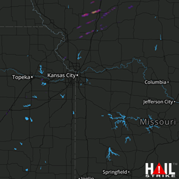 KANSAS CITY (KEAX) RADAR

