This weather event on September 20, 2025 includes:
4 states
28 counties,
12 cities,
and 77 zip codes.
There were 412 total properties that were impacted and have possible damage.
States Impacted By Hail On September 20, 2025
Colorado
·
Kansas
·
Oklahoma
·
Texas
Counties Impacted By Hail On September 20, 2025
Baca, CO
·
Barber, KS
·
Clark, KS
·
Finney, KS
·
Harper, KS
·
Kearny, KS
·
Meade, KS
·
Morton, KS
·
Reno, KS
·
Rice, KS
·
Stafford, KS
·
Alfalfa, OK
·
Beaver, OK
·
Custer, OK
·
Dewey, OK
·
Ellis, OK
·
Garfield, OK
·
Grant, OK
·
Major, OK
·
Roger Mills, OK
·
Texas, OK
·
Woods, OK
·
Woodward, OK
·
Hansford, TX
·
Hemphill, TX
·
Lipscomb, TX
·
Ochiltree, TX
·
Roberts, TX
Cities Impacted By Hail On September 20, 2025
Alva, OK
·
Chester, OK
·
Dacoma, OK
·
Enid, OK
·
Fargo, OK
·
Freedom, OK
·
Gage, OK
·
Hardesty, OK
·
Jefferson, OK
·
Knowles, OK
·
Mutual, OK
·
Woodward, OK
Zip Codes Impacted By Hail On September 20, 2025
67003
·
67104
·
67502
·
67514
·
67546
·
67568
·
67578
·
67579
·
67581
·
67583
·
67831
·
67838
·
67840
·
67844
·
67846
·
67851
·
67860
·
67864
·
67953
·
73625
·
73628
·
73638
·
73639
·
73642
·
73654
·
73659
·
73701
·
73703
·
73716
·
73717
·
73722
·
73727
·
73728
·
73729
·
73731
·
73737
·
73741
·
73749
·
73753
·
73758
·
73759
·
73761
·
73766
·
73768
·
73771
·
73832
·
73835
·
73838
·
73840
·
73842
·
73843
·
73844
·
73852
·
73853
·
73857
·
73858
·
73859
·
73860
·
73932
·
73942
·
73944
·
79005
·
79014
·
79024
·
79033
·
79034
·
79046
·
79056
·
79070
·
79081
·
79093
·
81090
·
73848
·
73801
·
73726
·
67522
·
67070
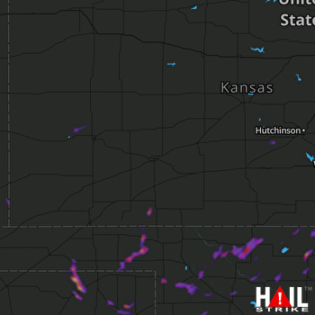 DODGE CITY (KDDC) RADAR

