This weather event on September 19, 2025 includes:
4 states
32 counties,
12 cities,
and 71 zip codes.
There were 716 total properties that were impacted and have possible damage.
States Impacted By Hail On September 19, 2025
Alabama
·
Arkansas
·
Louisiana
·
Mississippi
Counties Impacted By Hail On September 19, 2025
Choctaw, AL
·
Clarke, AL
·
Sumter, AL
·
Ashley, AR
·
Chicot, AR
·
Madison, LA
·
Morehouse, LA
·
Adams, MS
·
Claiborne, MS
·
Clarke, MS
·
Copiah, MS
·
Franklin, MS
·
Hinds, MS
·
Issaquena, MS
·
Jasper, MS
·
Jefferson, MS
·
Jefferson Davis, MS
·
Lamar, MS
·
Lauderdale, MS
·
Lawrence, MS
·
Lincoln, MS
·
Madison, MS
·
Neshoba, MS
·
Newton, MS
·
Noxubee, MS
·
Rankin, MS
·
Scott, MS
·
Sharkey, MS
·
Simpson, MS
·
Smith, MS
·
Washington, MS
·
Wayne, MS
Cities Impacted By Hail On September 19, 2025
Beauregard, MS
·
Byram, MS
·
Clinton, MS
·
Enterprise, MS
·
Flora, MS
·
Fulton, AL
·
Jackson, MS
·
Monticello, MS
·
Pelahatchie, MS
·
Polkville, MS
·
Tallulah, LA
·
Wesson, MS
Zip Codes Impacted By Hail On September 19, 2025
36446
·
36451
·
36784
·
36904
·
36907
·
36912
·
36919
·
38731
·
38744
·
38745
·
38748
·
39041
·
39042
·
39044
·
39059
·
39069
·
39071
·
39073
·
39074
·
39078
·
39083
·
39086
·
39092
·
39096
·
39114
·
39117
·
39120
·
39144
·
39145
·
39149
·
39154
·
39159
·
39170
·
39175
·
39191
·
39202
·
39216
·
39272
·
39301
·
39305
·
39307
·
39322
·
39323
·
39330
·
39336
·
39337
·
39338
·
39341
·
39345
·
39347
·
39350
·
39355
·
39361
·
39365
·
39367
·
39474
·
39475
·
39654
·
39661
·
39663
·
39665
·
71220
·
71232
·
71282
·
71640
·
71653
·
71661
·
39601
·
39348
·
39056
·
36908
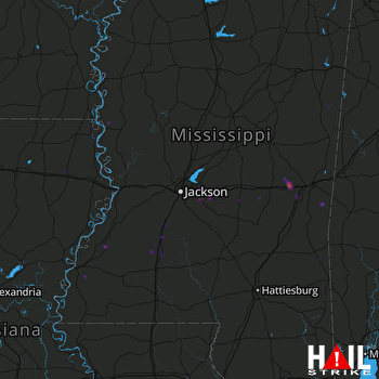 JACKSON (KDGX) RADAR

