This weather event on September 13, 2025 includes:
2 states
19 counties,
22 cities,
and 65 zip codes.
There were 1356 total properties that were impacted and have possible damage.
States Impacted By Hail On September 13, 2025
Indiana
·
Kentucky
Counties Impacted By Hail On September 13, 2025
Bartholomew, IN
·
Brown, IN
·
Clark, IN
·
Crawford, IN
·
Decatur, IN
·
Fayette, IN
·
Hamilton, IN
·
Hancock, IN
·
Harrison, IN
·
Jackson, IN
·
Jennings, IN
·
Johnson, IN
·
Marion, IN
·
Scott, IN
·
Shelby, IN
·
Tipton, IN
·
Washington, IN
·
Breckinridge, KY
·
Meade, KY
Cities Impacted By Hail On September 13, 2025
Campbellsburg, IN
·
Clifford, IN
·
Columbus, IN
·
Connersville, IN
·
Cordry Sweetwater Lakes, IN
·
Elizabethtown, IN
·
English, IN
·
Fortville, IN
·
Freetown, IN
·
Hardinsburg, KY
·
Indianapolis city (balance), IN
·
Jonesville, IN
·
Leavenworth, IN
·
Little York, IN
·
Morristown, IN
·
New Palestine, IN
·
North Vernon, IN
·
Princes Lakes, IN
·
Seymour, IN
·
Shelbyville, IN
·
Spring Lake, IN
·
Tipton, IN
Zip Codes Impacted By Hail On September 13, 2025
40119
·
40143
·
40144
·
40146
·
40157
·
40161
·
46030
·
46031
·
46034
·
46040
·
46055
·
46060
·
46062
·
46068
·
46072
·
46110
·
46117
·
46124
·
46126
·
46130
·
46131
·
46140
·
46160
·
46161
·
46162
·
46163
·
46164
·
46176
·
46181
·
46239
·
47102
·
47106
·
47108
·
47110
·
47112
·
47117
·
47123
·
47135
·
47137
·
47142
·
47165
·
47167
·
47170
·
47203
·
47220
·
47226
·
47229
·
47232
·
47234
·
47235
·
47240
·
47244
·
47246
·
47247
·
47260
·
47265
·
47272
·
47274
·
47281
·
47283
·
47331
·
47448
·
47201
·
47118
·
40104
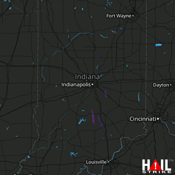 INDIANAPOLIS (KIND) RADAR

