This weather event on September 11, 2025 includes:
2 states
15 counties,
18 cities,
and 61 zip codes.
There were 116 total properties that were impacted and have possible damage.
States Impacted By Hail On September 11, 2025
North Dakota
·
South Dakota
Counties Impacted By Hail On September 11, 2025
Benson, ND
·
Bottineau, ND
·
Bowman, ND
·
McHenry, ND
·
McLean, ND
·
Nelson, ND
·
Pierce, ND
·
Ramsey, ND
·
Renville, ND
·
Rolette, ND
·
Towner, ND
·
Ward, ND
·
Wells, ND
·
Harding, SD
·
Perkins, SD
Cities Impacted By Hail On September 11, 2025
Bantry, ND
·
Berthold, ND
·
Bisbee, ND
·
Brinsmade, ND
·
Cando, ND
·
Carpio, ND
·
Churchs Ferry, ND
·
Crary, ND
·
Devils Lake, ND
·
Kief, ND
·
Lansford, ND
·
Maxbass, ND
·
Mylo, ND
·
Overly, ND
·
Rolette, ND
·
Starkweather, ND
·
Willow City, ND
·
Wolford, ND
Zip Codes Impacted By Hail On September 11, 2025
57640
·
58301
·
58317
·
58318
·
58321
·
58324
·
58325
·
58329
·
58331
·
58332
·
58341
·
58343
·
58344
·
58345
·
58346
·
58348
·
58351
·
58353
·
58362
·
58363
·
58366
·
58368
·
58370
·
58377
·
58379
·
58381
·
58382
·
58384
·
58385
·
58386
·
58531
·
58575
·
58653
·
58701
·
58703
·
58710
·
58712
·
58713
·
58716
·
58718
·
58725
·
58731
·
58735
·
58740
·
58748
·
58750
·
58759
·
58760
·
58762
·
58768
·
58778
·
58781
·
58783
·
58788
·
58789
·
58790
·
58792
·
58793
·
57638
·
58327
·
58736
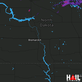 BISMARCK (KBIS) RADAR

