This weather event on August 20, 2025 includes:
2 states
25 counties,
25 cities,
and 86 zip codes.
There were 173 total properties that were impacted and have possible damage.
States Impacted By Hail On August 20, 2025
Oklahoma
·
Texas
Counties Impacted By Hail On August 20, 2025
Atoka, OK
·
Johnston, OK
·
Anderson, TX
·
Bell, TX
·
Burleson, TX
·
Burnet, TX
·
Cherokee, TX
·
Coryell, TX
·
Falls, TX
·
Freestone, TX
·
Grimes, TX
·
Houston, TX
·
Hunt, TX
·
Lampasas, TX
·
Lee, TX
·
Leon, TX
·
Limestone, TX
·
Madison, TX
·
McLennan, TX
·
Milam, TX
·
Mills, TX
·
Robertson, TX
·
San Saba, TX
·
Travis, TX
·
Williamson, TX
Cities Impacted By Hail On August 20, 2025
Bertram, TX
·
Bremond, TX
·
Buffalo, TX
·
Copperas Cove, TX
·
Florence, TX
·
Fort Hood, TX
·
Gallatin, TX
·
Georgetown, TX
·
Golinda, TX
·
Harker Heights, TX
·
Hewitt, TX
·
Iola, TX
·
Jacksonville, TX
·
Jarrell, TX
·
Jewett, TX
·
Killeen, TX
·
Lorena, TX
·
Lott, TX
·
Marlin, TX
·
Neylandville, TX
·
Robinson, TX
·
Rusk, TX
·
Serenada, TX
·
Temple, TX
·
Troy, TX
Zip Codes Impacted By Hail On August 20, 2025
73447
·
73460
·
74525
·
74555
·
74569
·
74856
·
75401
·
75422
·
75428
·
75785
·
75801
·
75803
·
75831
·
75833
·
75835
·
75838
·
75839
·
75840
·
75844
·
75846
·
75849
·
75850
·
75851
·
75852
·
75855
·
75860
·
76501
·
76504
·
76511
·
76513
·
76522
·
76524
·
76527
·
76528
·
76530
·
76537
·
76541
·
76542
·
76543
·
76544
·
76548
·
76549
·
76550
·
76557
·
76567
·
76571
·
76577
·
76578
·
76579
·
76629
·
76630
·
76632
·
76642
·
76643
·
76653
·
76655
·
76656
·
76661
·
76680
·
76682
·
76685
·
76687
·
76832
·
76844
·
76853
·
76877
·
77831
·
77836
·
77856
·
77864
·
77865
·
77871
·
77872
·
78605
·
78608
·
78626
·
78628
·
78633
·
78641
·
78642
·
78654
·
78947
·
77861
·
76706
·
75925
·
75766
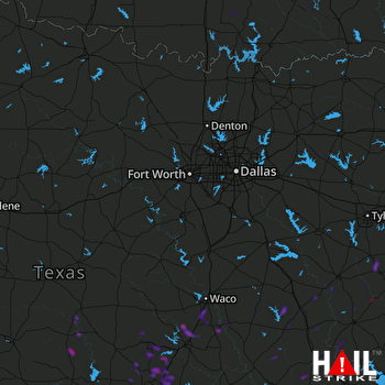 DALLAS/FTW (KFWS) RADAR

